Tropical downpours expected in Houston, prompting ABC13 Weather Alert days

KTRK logo
Last updated: Tuesday, June 16, 2026 1:04AM GMT
ABC13 Houston 24/7 Live Stream

HOUSTON, Texas (KTRK) -- At least two weather systems will converge, bringing torrential downpours that could lead to severe flooding in parts of Southeast Texas, prompting an ABC13 Weather Alert Day issued for Monday, Tuesday, and Wednesday. Thursday has also been declared an ABC13 Weather Watch Day.

The ABC13 Weather Team said to expect an average of 3 to 6 inches of rain, leading to the potential for flash flooding in Houston through Thursday morning.

Drivers will need to exercise caution over the next few days and be aware of high-water spots.

Stay weather aware with ABC13 throughout the week for additional alerts and the latest on your forecast.


KTRK logo
Jun 15, 2026, 8:04 PM GMT

High water reported on IH-45 North HOV northbound at Travis Street in downtown: Houston TranStar

As the ABC13 Weather Alert Day continues on Monday, multiple high water locations have been reported across downtown Houston by TranStar.

According to Houston TranStar, high water was reported on IH-45 North HOV northbound at Travis Street. Cameras captured the flooding near downtown Houston on Monday afternoon.

KTRK logo
Jun 15, 2026, 6:48 PM GMT

High water locations reported across Houston area due to storms

Drivers should be cautious of high water spots popping up in the Houston area as storms move through on Monday.

Houston TranStar cameras showed water rising on the North Freeway at the Patton exit at about 1 p.m.

High water was seen along I-45 North near the North Main and Patton exits on Monday, June 15, 2026. (Houston TranStar)

METRO officials on social media said the HOV/HOT lanes on I-45 North are closed for outbound travel due to high water.

High water spots reported by Transtar:

Jun 15, 2026, 6:19 PM GMT

Houston mail carrier stuck in ditch with high water

As Harris County remains under a Flood Watch, crews are capturing some problem areas on the roadways on Monday afternoon.

ABC13 Storm Chaser Jamie Garcia was out and found a United States Postal Service mail carrier grabbing her belongings and exiting her mail carrier, which was submerged in a ditch with high water off Ella Boulevard near Judiway Street.

Storm Chaser Jamie Garcia caught a postal worker's truck submerged in a high water ditch

Harris County remains under the watch until 2:15 p.m.

KTRK logo
Jun 15, 2026, 4:46 PM GMT

Multiple Flash Flood Watches issued across SE Texas

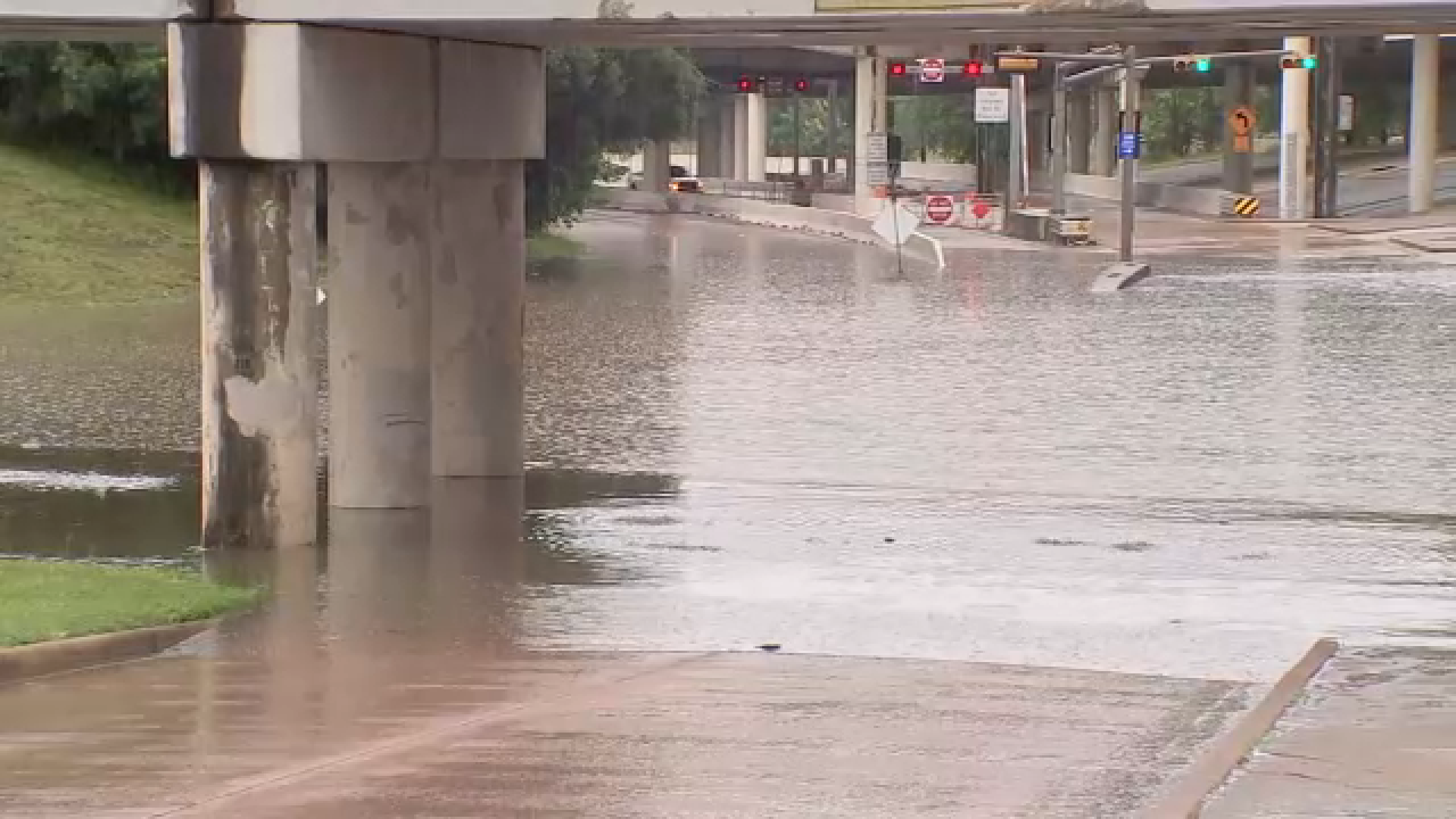
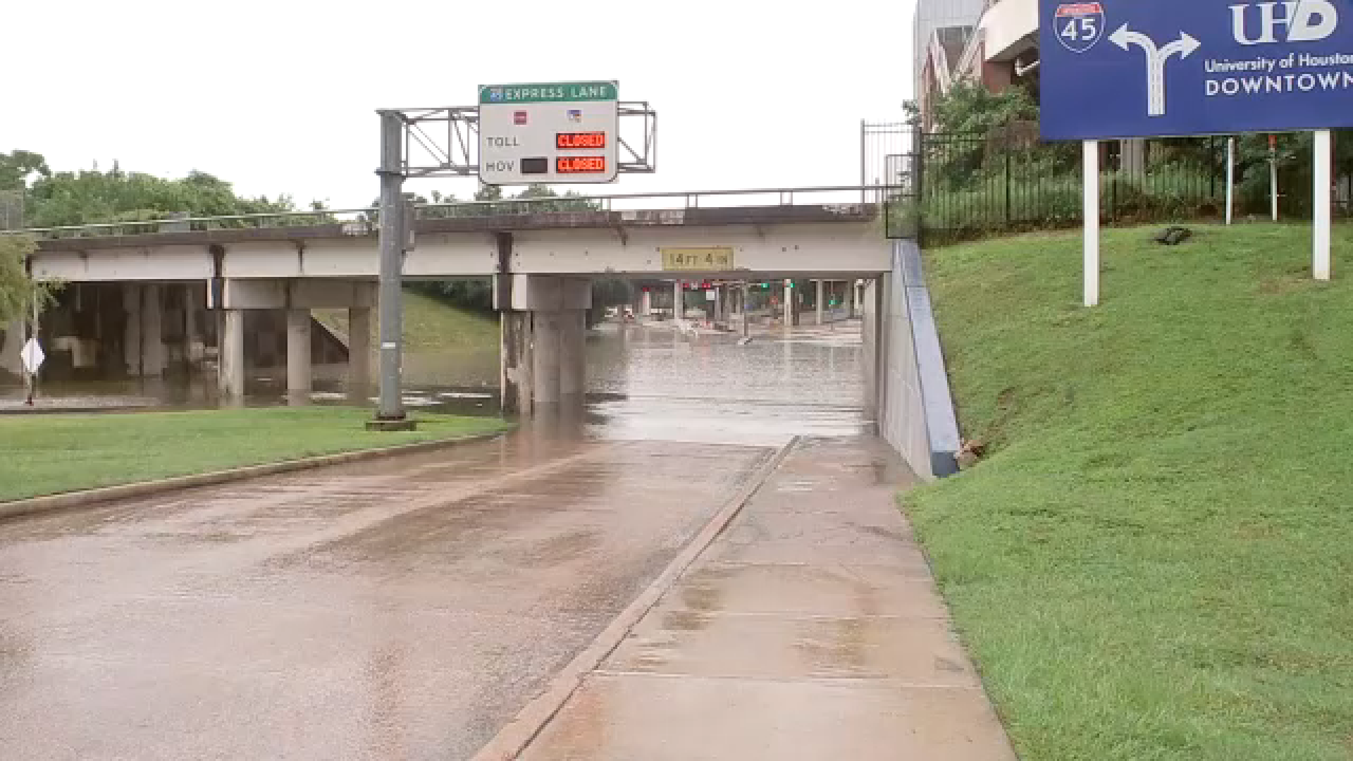
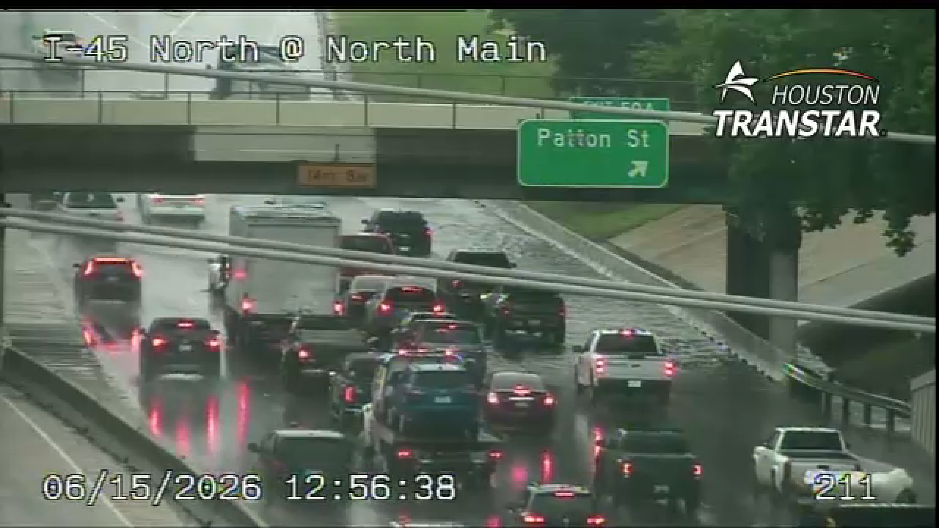
At least 10+ counties are under Flood Watches until Thursday morning at 7 a.m., as Southeast Texas is expected to see several inches of rain over the next few days.

The National Weather Service is spotlighting the "potential for life-threatening flash flooding" in Southeast Texas, adding that "there is an increased danger to lives and property due to flash flooding."

The counties listed below are under the flood watches, according to the NWS:

Houston; Trinity; Madison; Walker; San Jacinto; Polk; Burleson; Brazos; Washington; Grimes; Montgomery; Northern Liberty; Colorado; Austin; Waller; Inland Harris; Chambers; Wharton; Fort Bend; Inland Jackson; Inland Matagorda; Inland Brazoria; Inland Galveston; Southern Liberty; Coastal Harris; Coastal Jackson; Coastal Matagorda; Coastal Brazoria; Coastal Galveston; Matagorda Islands; Brazoria Islands; Galveston Island; Bolivar Peninsula.

There is also a River Flood Warning in effect for Burleson County until 2:30 a.m. Wednesday morning.

There has also been a Flood Advisory in effect for Harris County until 1:15 p.m. on Monday.

For the latest breaking news, weather, and traffic, ABC13 is now live on Disney+. Always on, always under the live tab on Disney+ and everywhere you stream.