Jun 17, 2026, 7:01 PM GMT
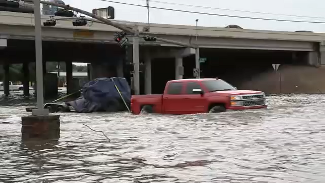
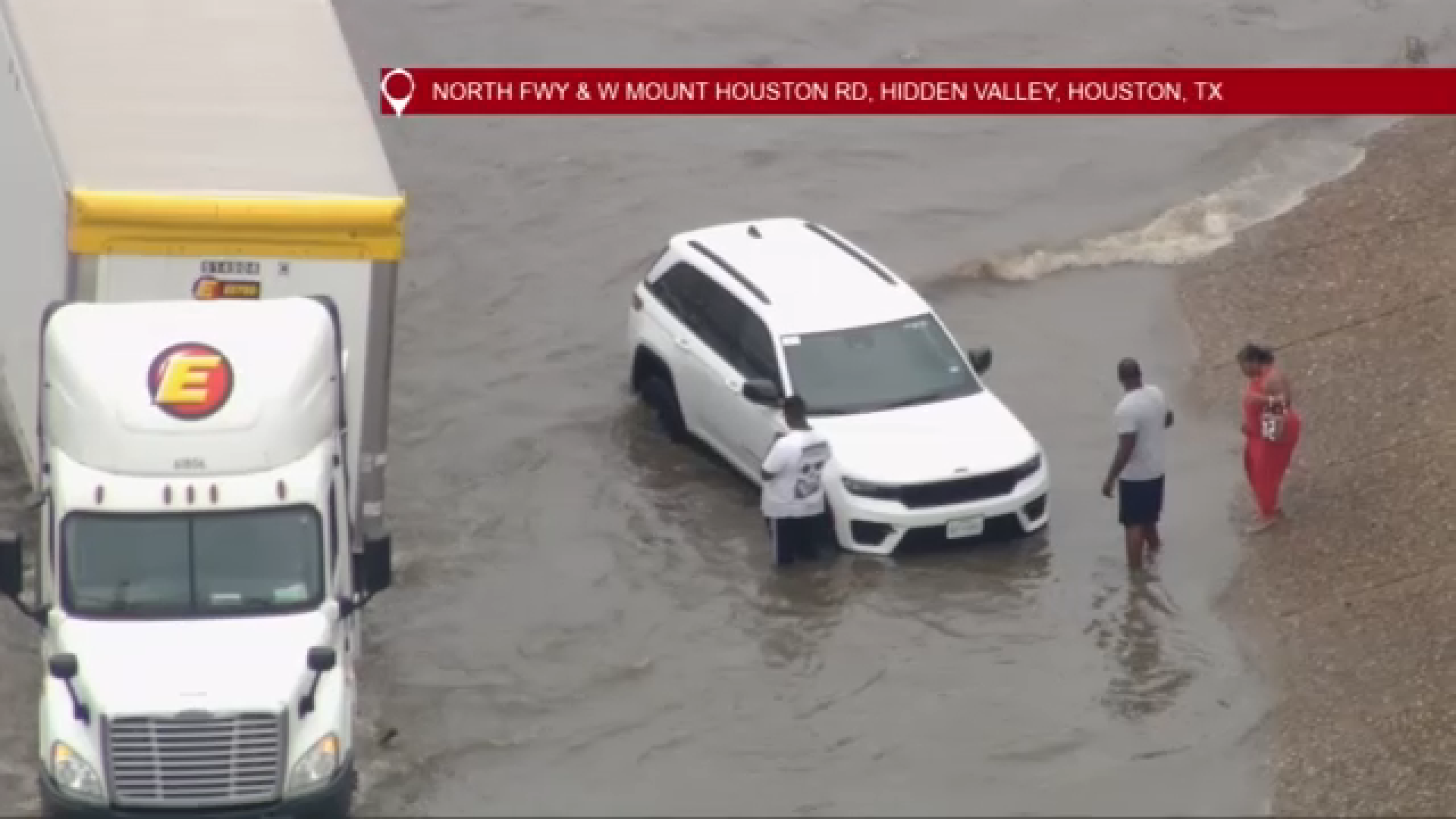
Motorists help each other as flooding continues, multiple cars stall near IH-45 at W. Mount Houston
Houstonians are stepping in to help as multiple cars are still stalled in the high water near IH-45 at W. Mount Houston.


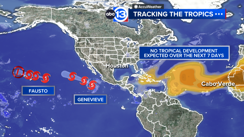
HOUSTON, Texas (KTRK) -- At least two weather systems are bringing torrential downpours that could lead to severe flooding in parts of Southeast Texas, which prompted ABC13 Weather Alert Days through Wednesday.
The ABC13 Weather Team said to expect an average of 3 to 6 inches of rain, leading to the potential for flash flooding in Houston through Thursday morning.
Drivers will need to exercise caution over the next few days and be aware of high-water spots.
Stay weather aware with ABC13 throughout the week for additional alerts and the latest on your forecast.
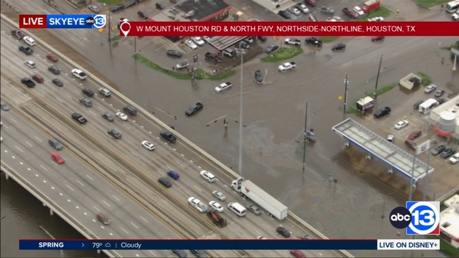
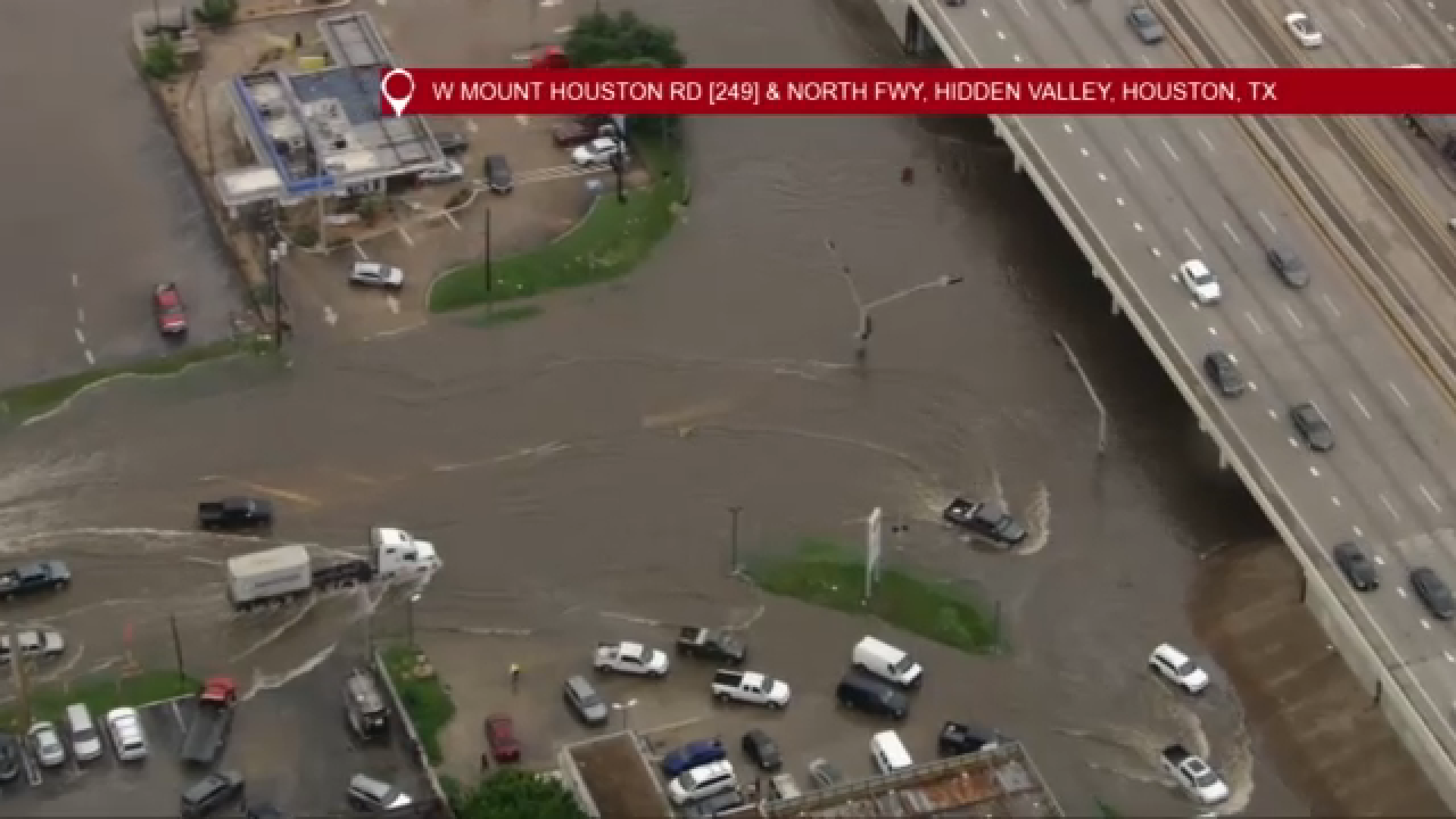
Houstonians are stepping in to help as multiple cars are still stalled in the high water near IH-45 at W. Mount Houston.
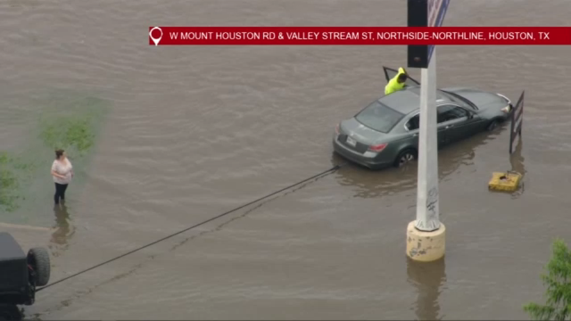
SkyEye13 was over a high-water location as reported by Houston TranStar near IH-45 at W. Mount Houston, capturing images of cars attempting to drive through flooded roadways, with some vehicles even stalled in the water.

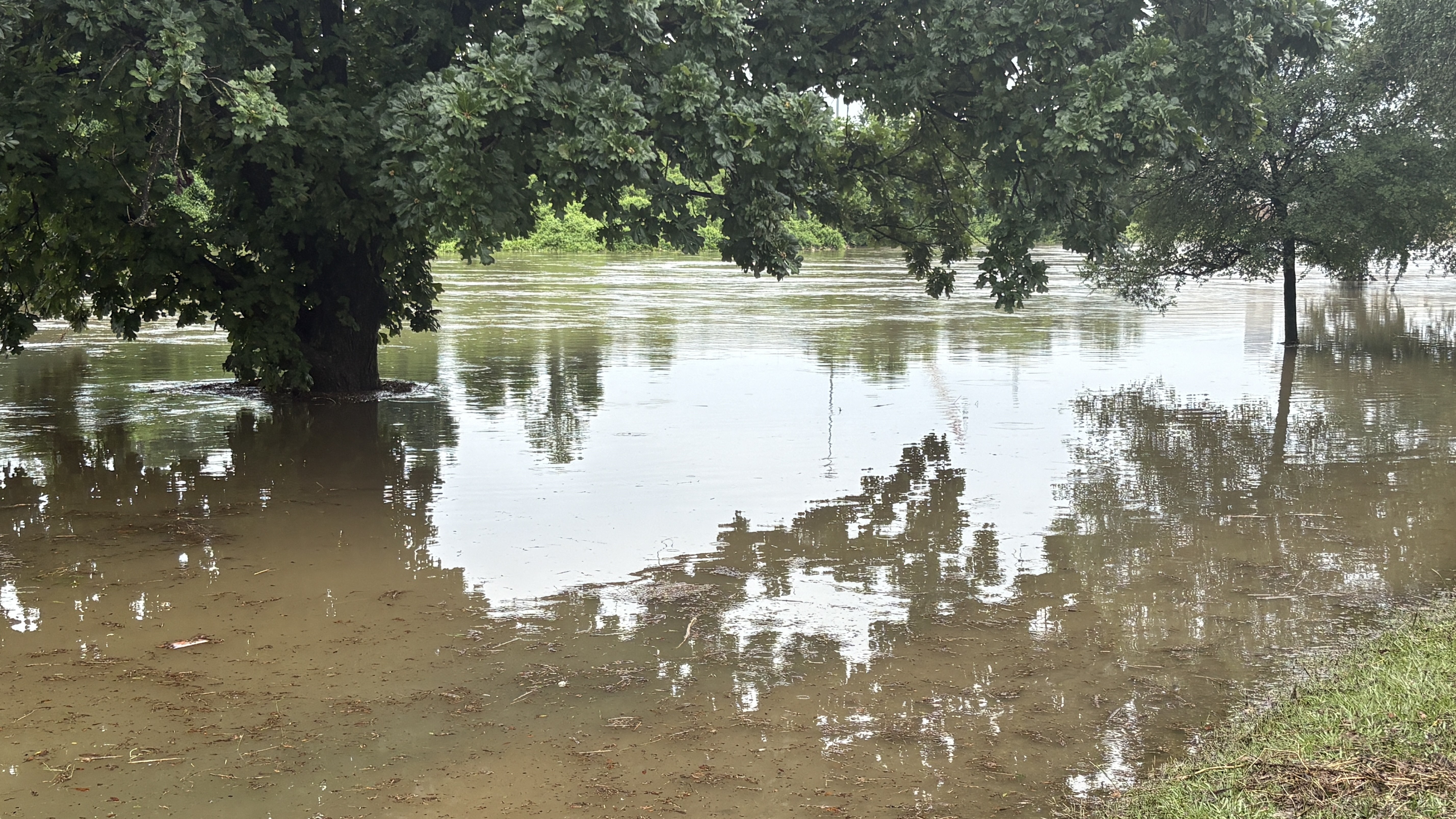
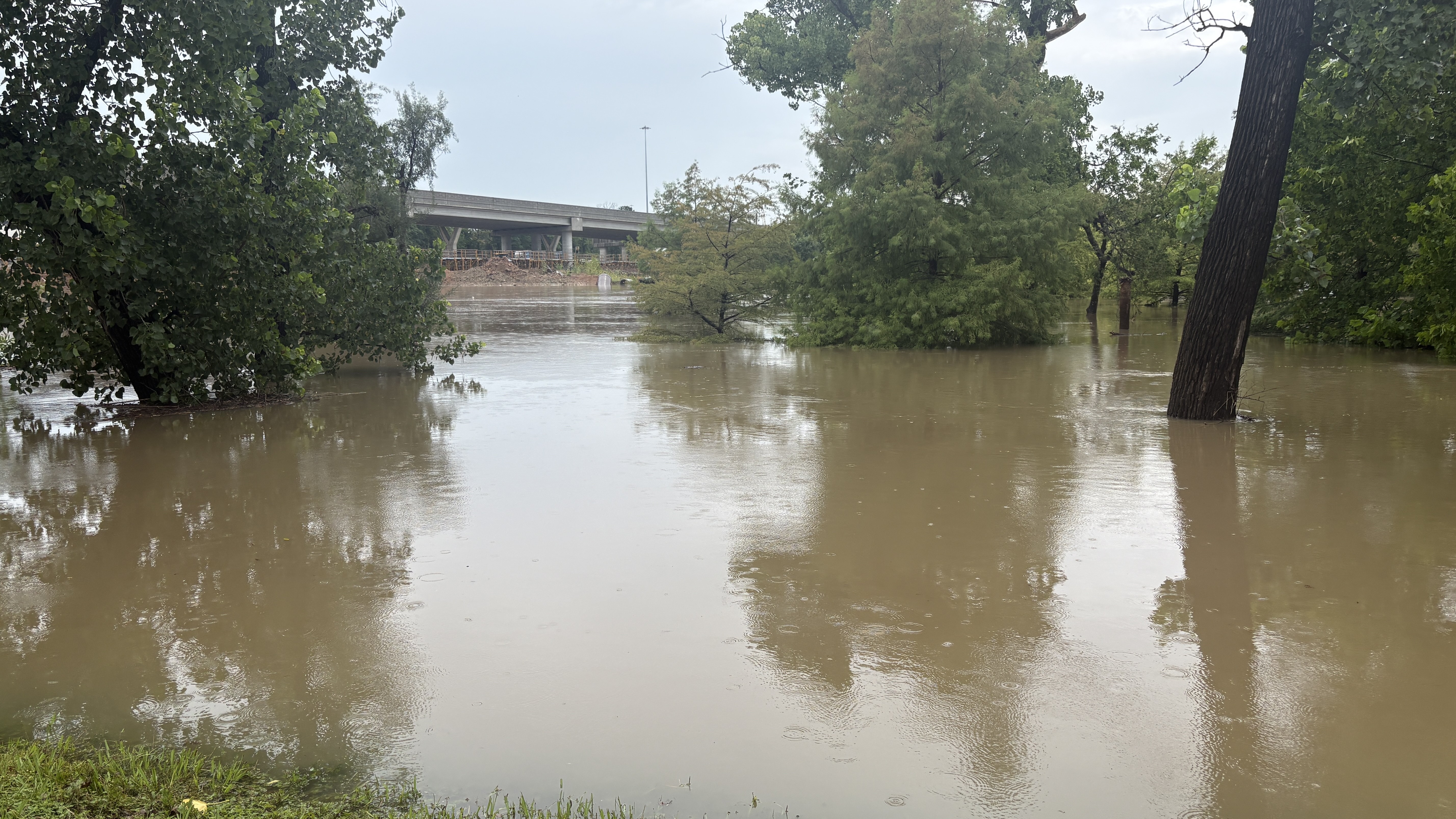
As the ABC13 Weather Alert Day continues into Monday evening, White Oak Bayou has topped its banks, causing a high water location on the greenway, ABC13 images show.
ABC13 crews captured images of the flooding near White Oak Drive and Sabine Street.
The City of Houston has announced it is activating several preparedness measures as the potential for heavy rainfall and flash flooding continues across the region.
City officials said that Houston Public Works is lowering Lake Houston, placing barricades at flood-prone locations, and preparing dump trucks to assist with potential high-water challenges that may arise.
The Houston Police Department and Houston Fire Department have placed high-water rescue vehicles and boats throughout the city, according to officials.
Officials also said the city's Office of Emergency Management activated the City's Emergency Operations Center at 8 a.m. on Monday to coordinate response efforts and monitor weather conditions.
City leaders warned that during periods of heavy rainfall, some roadways around Houston may temporarily hold water, adding that they are designed to drain quickly to help reduce the risk of structural flooding.
Houston officials advised the public to use patience and caution when travelling through the city, encouraging motorists to slow down, allow extra time to travel, and to never drive through flooded roadways.
"We are taking every step to prepare for this weather and keep our community safe," Houston Mayor John Whitmire said. "I urge residents and visitors alike to stay informed, use caution on the roads, and never drive through flooded streets. By working together and following official guidance, we can help keep everyone safe."
Houston city officials shared that people can text AlertHouston to 888777 to receive important updates and emergency information.