Travis Herzog explains what makes some winter precipitation more dangerous


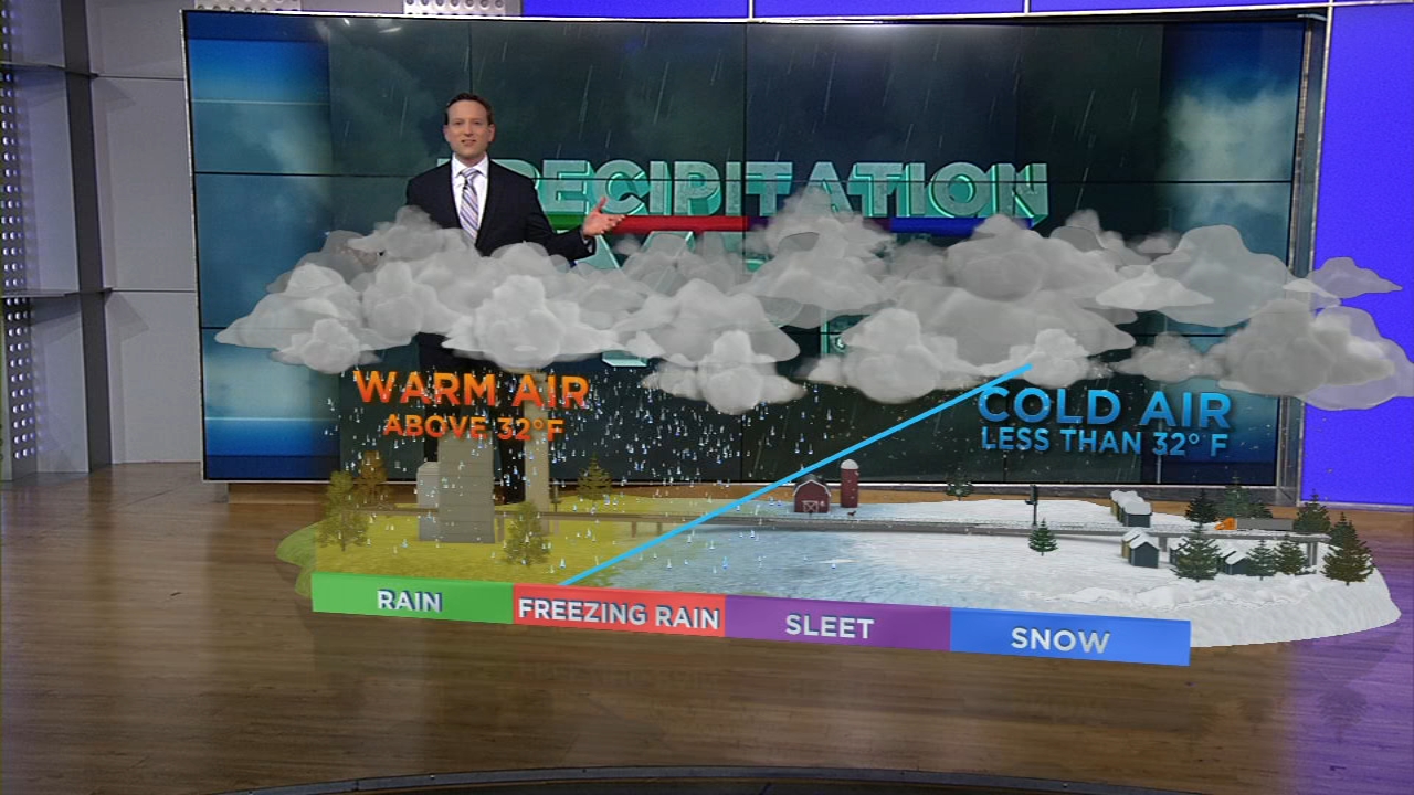
In the winter, we can see many different types of precipitation.
The type of precipitation that we see actually has to do with the temperature, not just at the surface, but also the temperature between the cloud and the ground.
The first type of precipitation is rain. Inside the cloud, rain can start off as ice crystals or water droplets. But you get rain when you have warm air from the cloud to the ground. Rain stays in its liquid state once it falls from the cloud and travels to the surface.
SEE ALSO: What are the record coldest temperatures recorded in Houston?
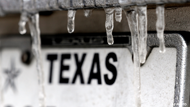
The next type of precipitation is freezing rain. This is when you have warm air from the cloud to just above the surface. At the surface, though, we have cold, at or below freezing air, which causes the rain to freeze on impact.
This is possibly the most dangerous option for winter precipitation. The freezing rain could create an icy glaze over roadways, sidewalks and power lines.
Then we have sleet. Sleet is when there is a warm layer just below the cloud so it falls as a liquid, but then encounters a large area of freezing air. This causes the rain to freeze into ice pellets before making it to the ground.
Lastly, we have snow. This is when you have cold, freezing air from the cloud to the surface. This allows the ice crystals to stay as ice crystals all the way down to the ground.