Tropical Depression Edouard could produce flash flooding Wednesday

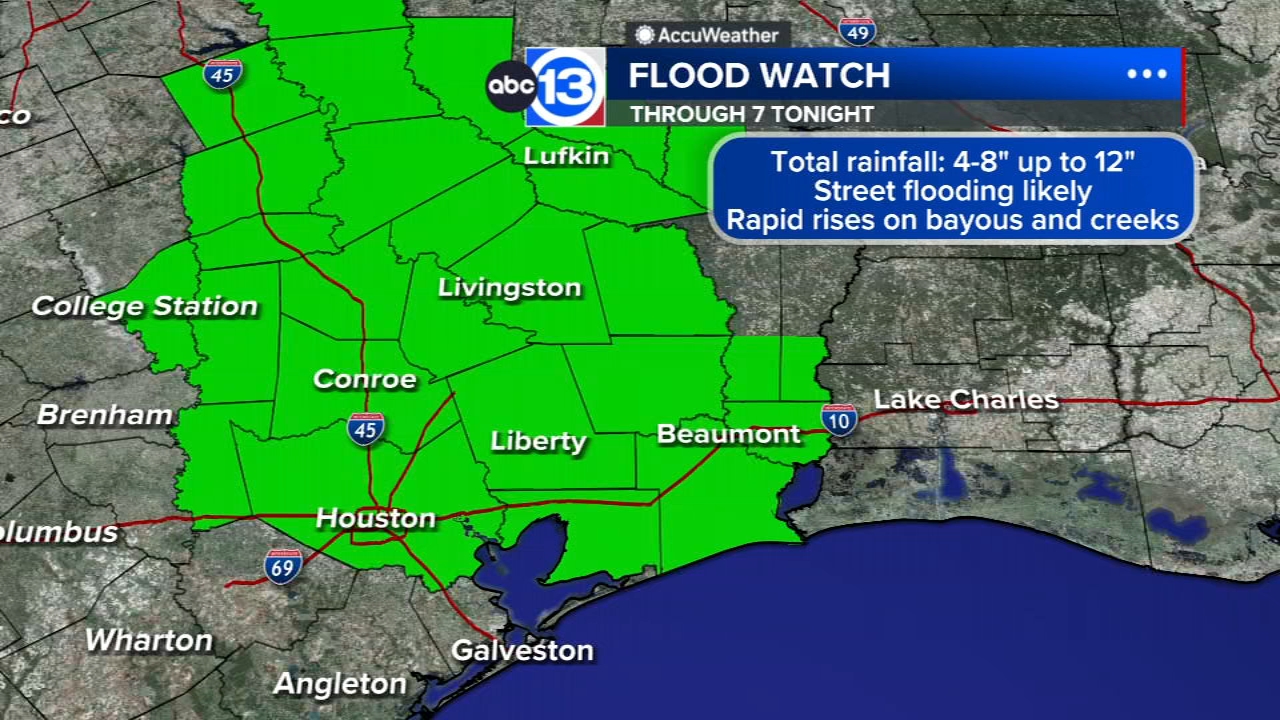
HOUSTON, Texas (KTRK) -- As Edouard continues to swirl over Southeast Texas, street and flash flooding will be possible with heavy, tropical downpours Wednesday.
Wednesday morning Edouard is centered over the Piney Woods as a tropical depression with winds of 35 mph. Heavy feeder bands of tropical rainfall continue to swirl over Polk, San Jacinto, Montgomery and Liberty counties where Flash Flood Warnings are in effect. Some regions have received between 4 to 16 inches of rain so far, enough that could lead to significant street and urban flooding as well as life-threatening flash flooding at times. A Flash Flood Emergency is in effect for portions of Tyler and Hardin counties to our east, where nearly two feet of rain has fallen. If your area is issued a Flash Flood Warning Wednesday morning, anticipate that nearby street could be flooded and impassable and regions that are flood prone will likely take on water.
These heavy feeder bands will continue to swirl near the center of Edouard but thankfully the system will begin to pull away from Southeast Texas into Wednesday afternoon. Streaming bands of showers and storms will continue to develop Wednesday in the afternoon and evening. This could lead to street flooding for areas that haven't seen rainfall yet. That rainfall could then lead to further flash flooding in areas that already have picked up copious amounts of rain. Otherwise Wednesday will be a cloudy and humid day with temperatures in the upper 80s or low 90s.
What weather alerts are associated with this system?
A Flood Watch has been extended until 7 a.m. Thursday for Harris, Brazoria, Fort Bend, Galveston, Montgomery, Liberty, San Jacinto, Polk, Brazos, Grimes, Houston, Madison, Trinity and Waller counties. Additionally, a Wind Advisory is in effect until 1 p.m. Wednesday for our northeast counties. Winds will continue to gust to more than 40 mph there, possibly creating power outages.
What does the rest of the week look like?
Tropical moisture will remain in place and lead to additional isolated areas of flooding through Thursday. After that, scattered heavy downpours of rain will be possible each and every afternoon through the weekend.
How about an early outlook for Labor Day Weekend?
At this time, any tropical mischief related to Edouard should be out of here. We'll be back to a warm and calm weather pattern, which means hot afternoons with highs in the mid-upper 90s and the chance for a few pop-up showers both Monday and Tuesday.
What else are you tracking in the tropics?
Aside from Edouard, we are also tracking 3 tropical systems in the Pacific. For a more in-depth discussion on what's happening in the tropics, visit our Daily Tropical Update page.
13 ALERT RADAR MAPS:
Southeast Texas
Houston
Harris County
Galveston County
Montgomery/Walker/San Jacinto/Polk/Grimes Counties
Fort Bend/Wharton/Colorado Counties
Brazoria/Matagorda Counties
Have weather tips, videos, and photos?
Send it to ABC13 using the form below. If you have a video or photo to send, terms of use apply. If you don't, just hit 'skip upload' and send the details.