

ABC13 Houston Weather Radar for Southeast Texas

- Flood Warning
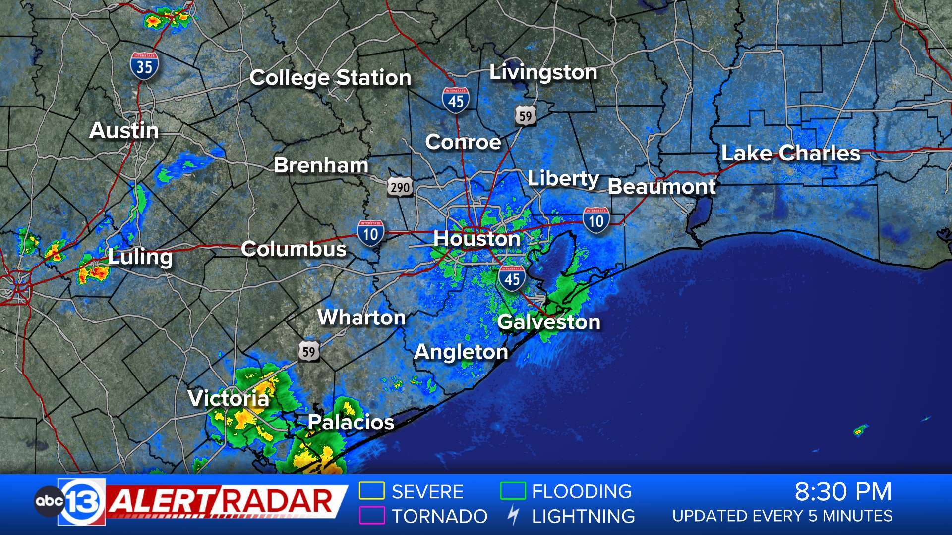
* WHAT...Small stream flooding caused by excessive rainfall is expected. * WHERE...A portion of southeast Texas, including the following counties, Harris and Montgomery. * WHEN...Until 230 PM CDT. * IMPACTS...Flooding of rivers, creeks, streams, and other low-lying and flood-prone locations is imminent or occurring. Streams continue to rise due to excess runoff from earlier rainfall. * ADDITIONAL DETAILS... - At 1228 PM CDT, Doppler radar and automated rain gauges indicated heavy rain due to thunderstorms. Flooding is ongoing or expected to begin shortly in the warned area. Between 3 and 5 inches of rain have fallen. - Additional rainfall amounts up to 1 inch are possible in the warned area. - Some locations that will experience flooding include... Conroe, Willis, The Woodlands, Oak Ridge North, Panorama Village, Shenandoah, Cut And Shoot, Montgomery, Woodloch, Lake Conroe Dam, The Woodlands Pavillion and Chateau Woods. - http://www.weather.gov/safety/floodMore
- Flood Warning
...Forecast flooding changed from Minor to Moderate severity and increased in duration for the following rivers in Texas... Tres Palacios River near Midfield affecting Wharton and Matagorda Counties. For the Tres Palacios River...including Midfield...Moderate flooding is forecast. * WHAT...Minor flooding is occurring and moderate flooding is forecast. * WHERE...Tres Palacios River near Midfield. * WHEN...From this morning to early tomorrow afternoon. * IMPACTS...At 26.0 feet, Moderate lowland flooding begins with water well into the floodplain on the right upstream bank and within inches of spilling over the east approach to the bridge at FM 456. The river will be almost one quarter mile wide in the vicinity of the gage. * ADDITIONAL DETAILS... - At 8:30 AM CDT Tuesday the stage was 25.6 feet. - Bankfull stage is 15.0 feet. - Recent Activity...The maximum river stage in the 24 hours ending at 8:30 AM CDT Tuesday was 25.6 feet. - Forecast...The river is expected to rise to a crest of 26.1 feet this afternoon. It will then fall below flood stage just after midnight tonight. - Flood stage is 24.0 feet. - Flood History...This crest compares to a previous crest of 26.2 feet on 04/19/2015. - http://www.weather.gov/safety/floodMore


