24/7 Live
Houston
Southwest
Southeast
Northwest
Northeast
Weather Forecast
Hurricane Guide
ABC13 Loves Teachers
Texas True Crime
ABC Price Tracker
Submit a News Tip
Community Events
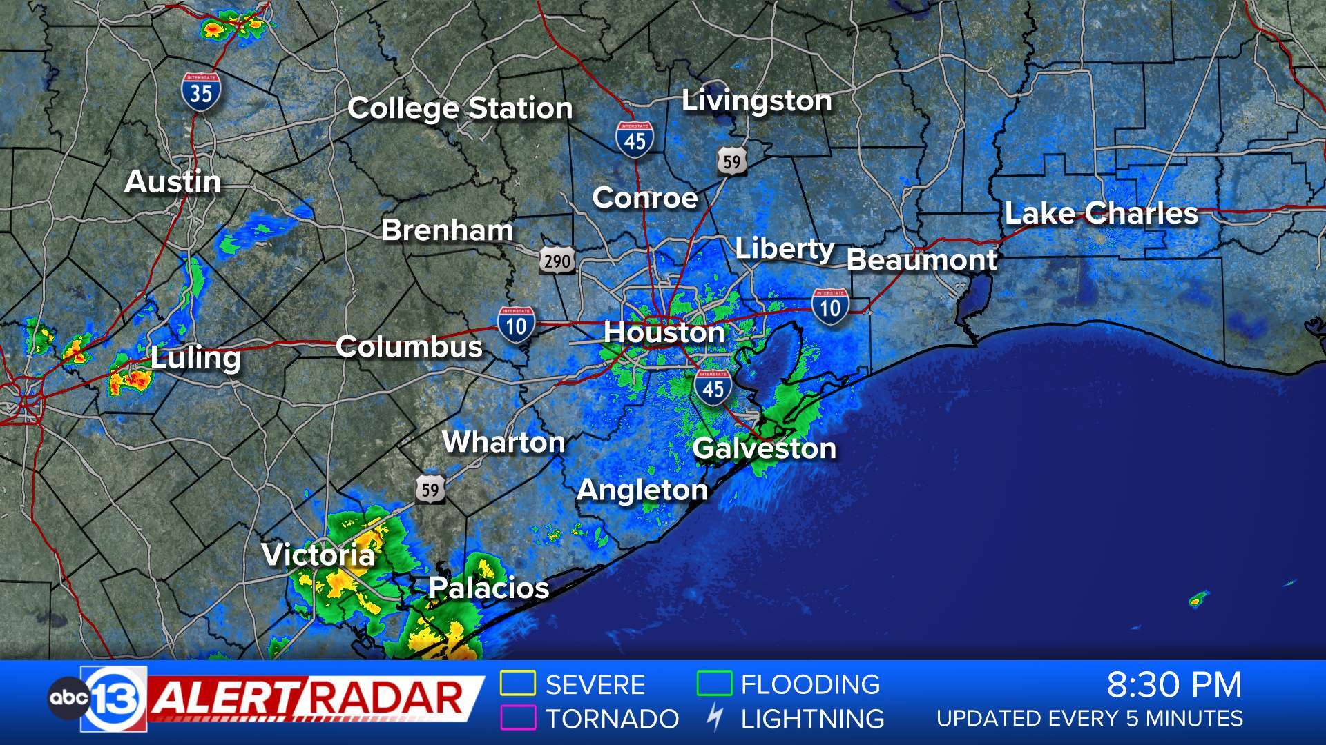
ABC13 Houston Weather Radar for Southeast Texas
Share
Tweet
Email
ABC13 Radar Network
Share
Tweet
Email
Animate
ABC13 Houston Weather Radar
ABC13 Houston Weather Radar for Harris County
ABC13 Houston Weather Radar for Galveston County
ABC13 Houston Weather Radar for Montgomery/Walker/San Jacinto/Polk/Grimes counties
ABC13 Houston Weather Radar for Fort Bend/Wharton/Colorado counties
ABC13 Houston Weather Radar for Brazoria/Matagorda counties
Show More
ABC13 Houston Weather Radar for Chambers/Liberty counties
ABC13 Houston Weather Radar for Waller/Austin/Washington/Fayette
Show Fewer
Live Web Cams
Lake Conroe Weather Camera
Houston Texas Live Camera on ABC13 Tower
Houston Texas Skyline View from Memorial Drive Camera
Galveston Live Beach Camera
See All Live Web Cams
Weather Team
Travis Herzog
David Tillman
Elita Loresca
Kevin Roth
Elyse Smith