Tropical Depression Edouard brings more rain to parts of Southeast Texas overnight

HOUSTON, Texas (KTRK) -- A Flood Watch continues overnight from Houston northward until 7 a.m. Thursday. Feeder bands from Edouard will continue to bring a threat of heavy rainfall to parts of Southeast Texas.
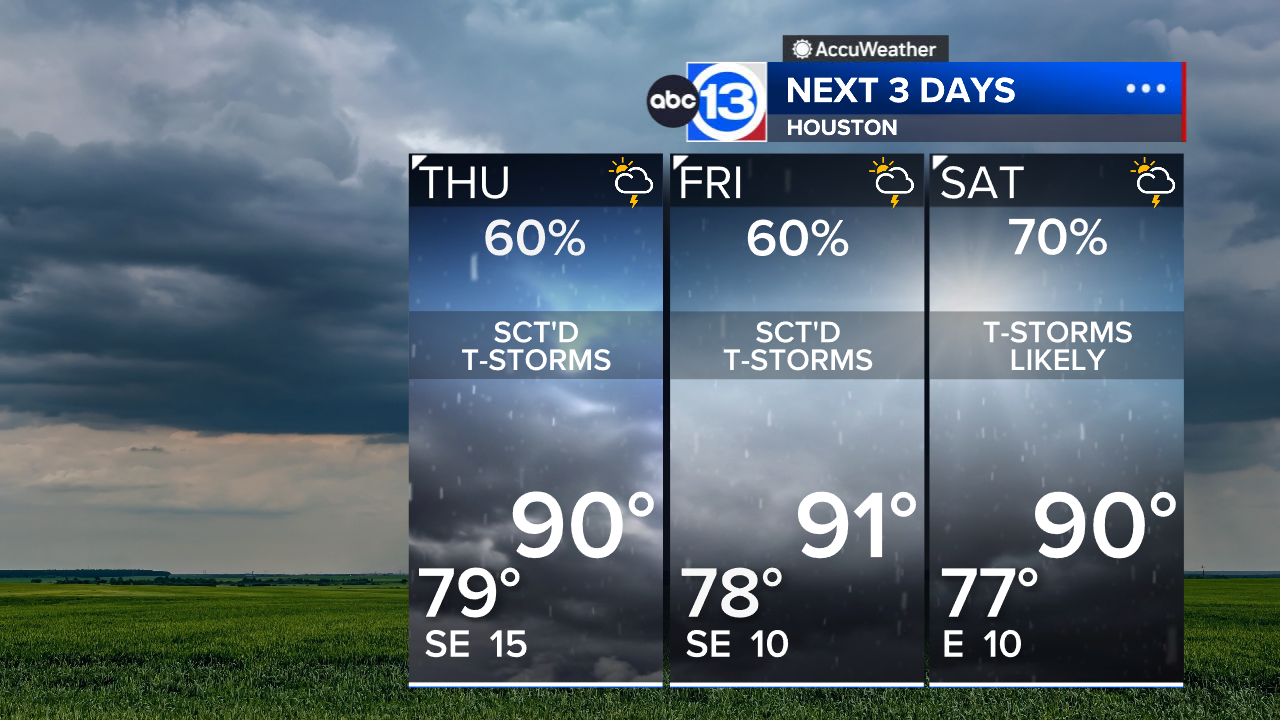
This feeder band will spread a lot of clouds overhead, so Thursday will start of cloudy with some lingering pockets of rain. It should be mostly rain-free by mid-day, then scattered downpours will pop up in the tropical air during the afternoon as temperatures top out around 90 degrees. Any storm that pops up could drop a quick inch or two of rain that leads to localized street flooding.
Which counties are included in the Flood Watch?
The Flood Watch includes Harris, Montgomery, Liberty, San Jacinto, Polk, Brazos, Grimes, Houston, Madison, Trinity, Walker and Waller counties. A quick 1-3" of rain are possible in the heavy bands of rain with isolated totals exceeding 6".
What does the rest of the week look like?
Tropical moisture will remain in place which will help bring Southeast Texas more showers and storms. This could lead to additional isolated areas of flooding through Thursday. After that, scattered heavy downpours of rain will be possible each and every afternoon through the weekend.
What should we expect for Labor Day Weekend?
At this time, any tropical mischief related to Edouard should be out of here. Saturday there will still be some higher levels of tropical moisture nearby, so that day could have more shower and storms activity than Sunday and Monday. We'll be back to a warm and calm weather pattern, which means hot afternoons with highs in the mid-upper 90s and the chance for a few pop-up showers both Monday and Tuesday.
What else are you tracking in the tropics?
Aside from Edouard, we are also tracking 3 tropical systems in the Pacific. For a more in-depth discussion on what's happening in the tropics, visit our Daily Tropical Update page.
13 ALERT RADAR MAPS:
Southeast Texas
Houston
Harris County
Galveston County
Montgomery/Walker/San Jacinto/Polk/Grimes Counties
Fort Bend/Wharton/Colorado Counties
Brazoria/Matagorda Counties
Have weather tips, videos, and photos?
Send it to ABC13 using the form below. If you have a video or photo to send, terms of use apply. If you don't, just hit 'skip upload' and send the details.