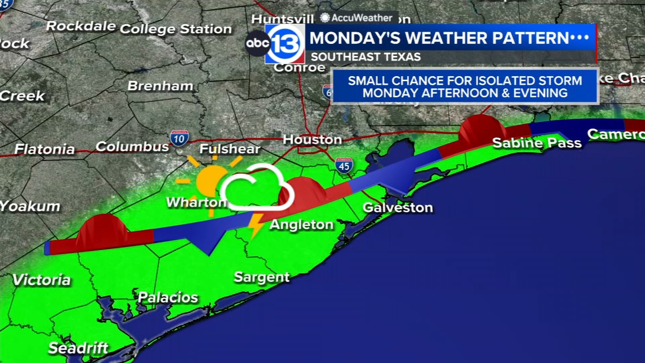
Another hot Monday could give way to an isolated storm or two in the afternoon

HOUSTON, Texas (KTRK) -- While it may not have felt as humid Sunday, it was still quite hot with highs close to 100 degrees. And it'll be just as hot for Monday, but this time the front that brought the lower humidity could also trigger a spot afternoon storm Monday.
We'll keep the clear sky and lower humidity through the evening with temperatures falling into the upper 70s overnight by Monday morning. It'll be another sunny and hot day with temperatures reaching 100 degrees in the afternoon. And the front that pushed through Southeast Texas over the weekend will still be nearby, which could lead to an isolated shower or storm developing in the afternoon or evening. Best chance for that will be along and south of I-10, and its only about a 20% chance for now so most of Southeast Texas will remain sunny and dry Monday. An Ozone Pollution Watch is back in place for Harris, Brazoria and Galveston counties with the chance for a reduction in air quality Monday afternoon.
It's August. How hot are things looking early on this month?
Well, thanks to this summertime cool front from over the weekend there will be a subtle drop in humidity levels for Sunday and Monday. But this will also allow for temperatures to rise a bit more quickly in the afternoon. So with the help of some sunshine too, highs will be in the upper 90s or even triple digits through Tuesday. By later in the week we'll see the return of our typical Houston humidity that will still keep a triple digit feels-like temperature in the forecast each afternoon this week and into the weekend.
Any more rain in the forecast?
Tuesday this stationary front should fizzle out, so after Monday's 20% chance rain chances drop to 10% Tuesday. By Wednesday there will be a daily 20% chance for a spot shower or storm to form in the afternoon with the help of the summertime sea breeze. By later this week another weak cool front could approach Southeast Texas into the weekend, with a small increase to 30% chance for showers and storms Saturday. Otherwise, there are no major rain chance or storm systems expected in the next 7-10 days.
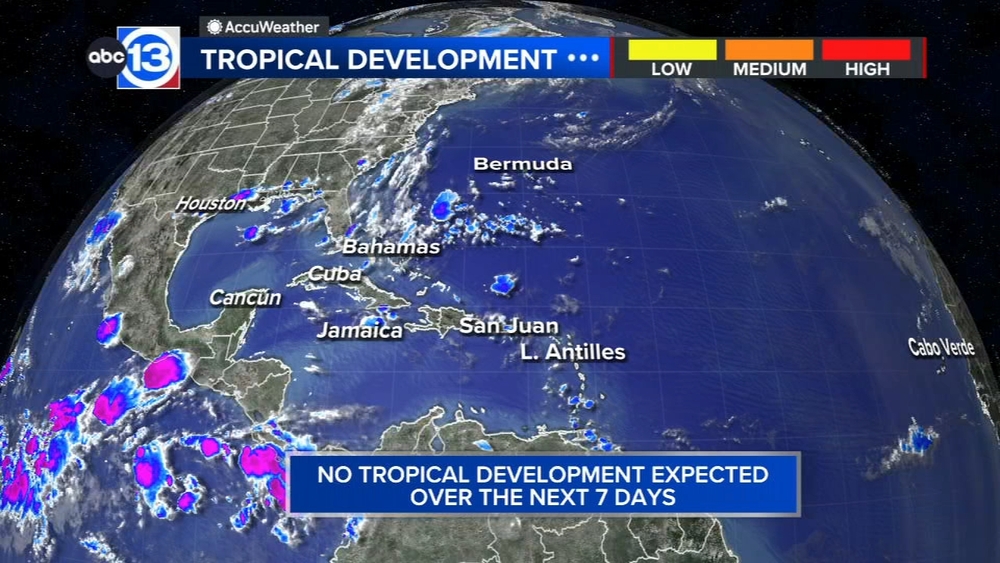
What are you tracking in the tropics?
Saharan dust is blowing through the Atlantic with a tropical storm in the Pacific. Visit our Tropical Update page for a more in-depth tropical weather discussion and forecast.
13 ALERT RADAR MAPS:
Southeast Texas
Houston
Harris County
Galveston County
Montgomery/Walker/San Jacinto/Polk/Grimes Counties
Fort Bend/Wharton/Colorado Counties
Brazoria/Matagorda Counties
Have weather tips, videos, and photos?
Send it to ABC13 using the form below. If you have a video or photo to send, terms of use apply. If you don't, just hit 'skip upload' and send the details.