Heavy rains have moved out, isolated storms possible Thursday with a drier weekend ahead


HOUSTON, Texas (KTRK) -- The heavy downpours that have led to street and area flooding this week are gone, but we can't rule out a few showers and storms Thursday afternoon. More seasonal summertime heat and sunshine returns for the weekend.
A few passing showers are possible Thursday as this stormy weather system continues to swirl over west Texas. Much of this rain is going to be light and scattered as this system pulls away from Southeast Texas for the rest of the week. Thursday will be a bit cloudy once again but not as rainy as what we've seen this week. Isolated showers and storms could pop up in the afternoon and bring brief heavy rainfall, thunder and lightning. The rain chance for Thursday is only at 30% and no flash flooding is expected. High temperatures will also be warmer with the drier day as highs climb to near 90 in the afternoon.
What does the weekend look like?
As of now, much drier! Looks like this stormy pattern will clear just in time for the weekend. This also means temperatures are going to warm up too. Expect more sunshine each day this weekend with highs back into the low-mid 90s.
What are you tracking in the tropics?
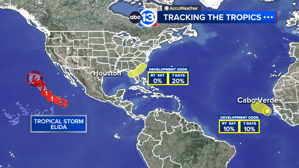
There are two areas the National Hurricane Center is monitoring for potential development. For now, impacts to Texas is unlikely. Visit our Tropical Update page for a more in-depth tropical weather discussion and forecast.
13 ALERT RADAR MAPS:
Southeast Texas
Houston
Harris County
Galveston County
Montgomery/Walker/San Jacinto/Polk/Grimes Counties
Fort Bend/Wharton/Colorado Counties
Brazoria/Matagorda Counties
Have weather tips, videos, and photos?
Send it to ABC13 using the form below. If you have a video or photo to send, terms of use apply. If you don't, just hit 'skip upload' and send the details.