How ABC13's new 13 Alert Radar network provides more accurate severe weather coverage

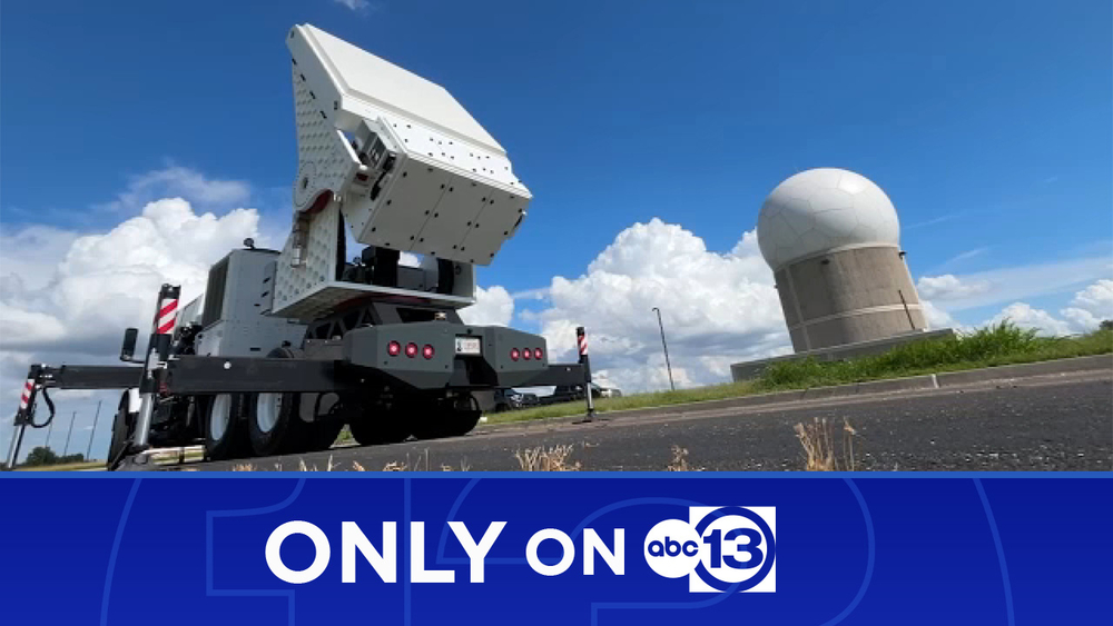
HOUSTON, Texas (KTRK) -- As Houston's severe weather leader, ABC13 is doubling down on our commitment to provide you with the most accurate forecast with superior technology by introducing the 13 Alert Radar network.
Houston is at the highest risk of billion-dollar weather disasters in the country, whether it's from hurricanes, tornadoes, flash floods, or winter storms.
With the frequency of extreme weather events increasing, it's more important than ever for us to have the best technology to keep you safe when severe weather strikes.
Watch the video above to see the complete 13 Alert Radar special, including Chief Meteorologist Travis Herzog's demonstration of how the new network system works.
Why a new radar system was needed
The United States is home to the most advanced radar network in the world called NEXRAD -- but even the best in the world is not perfect.
While the 160 radars in this network provide some degree of radar coverage to most of our nation, critical gaps are scattered throughout the country where we cannot see severe weather happening, including here in southeast Texas.
That's why ABC13 is investing in a new, private radar network operated by Climavision, a company that aims to fill those gaps and show you what we've been missing.
"This problem has been talked about for decades, but there's been relative inaction on many fronts. There's been all these gaps, but nothing comprehensive," Chris Goode with Climavision said. "So, I'm proud of the fact that we're stepping up as a private entity, working in partnership with the government, and actually stepping forward with a solution to a problem that's been talked about for a long time."
What have we been missing?
When it comes to severe weather, radar technology is life-saving. As the beam rotates around in a full circle, it gives us critical information on where storms are located, where they're going, and what's inside them.
Because the Earth is a sphere, as that radar beam spreads outward, it gains altitude and eventually leaves our atmosphere entirely.
So, the closer a storm is to the radar beam, the better the information we can get on what's happening in the lowest levels where the weather is impacting us.
As the beam travels farther out, it hits distant storms at higher and higher elevations, and after the beam travels just 60 miles, we can become blind to what's occurring near the ground.
So, what have we been missing?
"Lots of impactful weather can occur. You've seen it firsthand in the Houston area. There you can get smaller, tornadoes, EF-1s and 2s, that form at these very low levels and can go undetected by the existing network," Goode said.
This exact scenario occurred in southeast Texas during a Valentine's Day tornado outbreak in 2017. As David Tillman and Travis Herzog were tag-teaming continuous tornado coverage on live TV, an EF-1 tornado developed over the town of Van Vleck in Matagorda County.
The only problem is that we didn't know it. The existing National Weather Service radar network could not see the rotation, and a warning was never issued. Then, the damage reports started to come in.
How 13 Alert Radar fills the gaps
We are determined to make sure this never happens again.
Using Van Vleck as an example, the two closest radars in the National Weather Service's NEXRAD network are located near Houston and Corpus Christi. This creates a large gap in coverage southwest of Houston, where we cannot see what is happening below 5,000 feet -- until now.
The first radar we've added to the 13 Alert Radar network is located in Edna, Texas, effectively filling the gap that prevented us from seeing the Van Vleck tornado.
"One of our mantras is 'see what you've been missing.' And quite literally, people have been missing impactful weather at these lower levels. And by our deployment of radars in these gaps, we're going to be able to provide insights that have never been seen before in terms of breaking weather," Goode said.
We are just getting started, with plans for two additional radars to join the 13 Alert Radar Network in 2024, helping us to give you advanced warning and stay ahead of the storms.
"When you're talking about seconds and being able to provide better warning, better lead time, that can mean all the difference in a breaking weather event like a tornado or a severe thunderstorm," Goode said.
For weather updates, follow Travis Herzog on Facebook, Twitter and Instagram.


