Get ready for a dry, hazy, and hot weekend


HOUSTON, Texas (KTRK) -- Rain chances are on the way out, and the heat is cranking up!
What does the weekend look like?
Much drier than what we saw during most of the week! We have just a 10% chance of a spotty downpour today, with plenty of sunshine. The added sun will of course warm temperatures back up to typical July levels, with most of us reaching the mid 90s today and tomorrow. Feels-like temps will rise to the 102-105 degree range. A cloud of Saharan dust will be overhead the entire weekend as well, giving us a hazy sky.
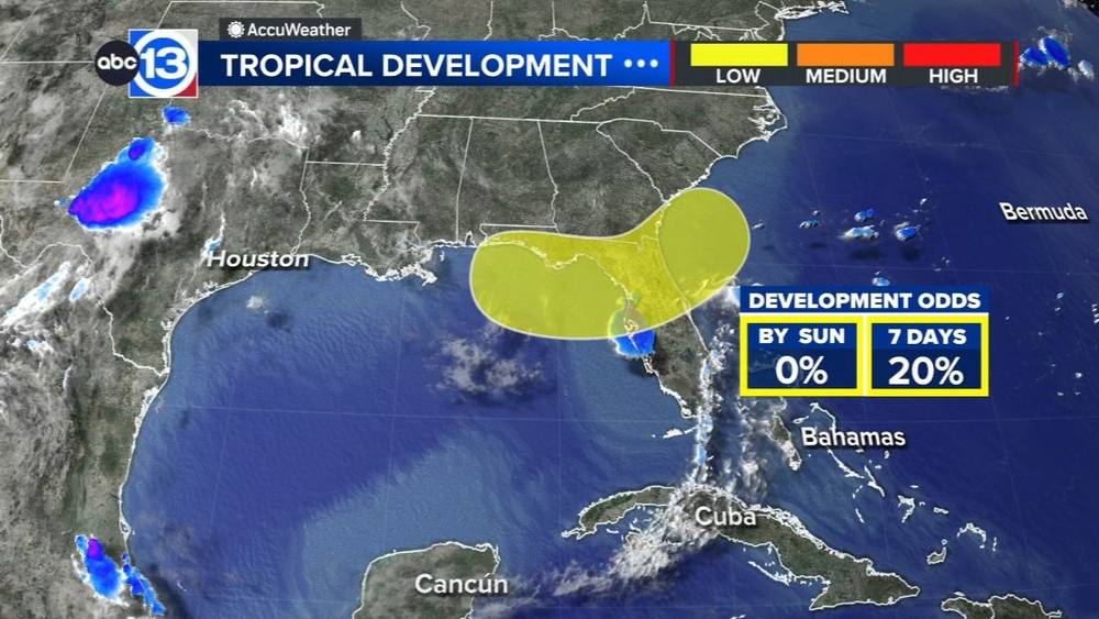
What are you tracking in the tropics?
There are two areas the National Hurricane Center is monitoring for potential development. There's a far east Atlantic wave near the Cabo Verde Islands that has a 10% chance. Closer to home, a disturbance in the eastern Gulf has a 30% chance to develop. For now, impacts to Texas are unlikely but not fully impossible, heavy rain is expected to fall over Florida and eventually Alabama, Georgia, and the Carolinas. Visit our Tropical Update page for a more in-depth tropical weather discussion and forecast.
13 ALERT RADAR MAPS:
Southeast Texas
Houston
Harris County
Galveston County
Montgomery/Walker/San Jacinto/Polk/Grimes Counties
Fort Bend/Wharton/Colorado Counties
Brazoria/Matagorda Counties
Have weather tips, videos, and photos?
Send it to ABC13 using the form below. If you have a video or photo to send, terms of use apply. If you don't, just hit 'skip upload' and send the details.