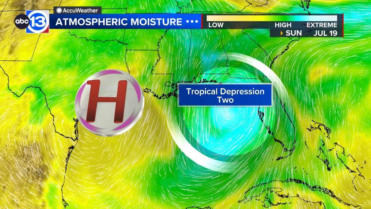
 Breaking from the National Hurricane Center, Tropical Depression 2 has officially formed in the eastern Gulf. The first look at the storm track from the NHC shows the potential for Texas to be impacted later this week (Thursday/Friday), but a lot of uncertainty remains in the exact track.
While the eastern Gulf is active, the western Gulf is quiet for now, with high pressure bringing another hot and hazy day with plenty of sunshine overhead. Highs will make it into the mid-upper 90s with an afternoon heat index near 105. A cloud of Saharan dust remains overhead, giving us a hazy sky.
What should we know about Tropical Depression Two?
TD2 is expected to strengthen, likely reaching Tropical Storm status within the next 24-48 hours, meaning an upgrade to "Tropical Storm Bertha" is very likely coming soon. Heavy rain is expected to fall over Florida and eventually Alabama, Georgia, and the Carolinas and the storm meanders northwestward over the next two days. By the time we hit Wednesday and Thursday, the storm will begin accelerating farther west, potentially pushing towards Texas in the Thursday/Friday timeframe. The path is not at all yet set in stone, and Hurricane Hunters will be flying through the region Sunday for the first time, which should help us pinpoint the eventual destination of this developing system.
So what's the outlook for the Houston area next week?
It's a tale of two stories across the Gulf Coast. The western gulf will stay hot and dry thanks to a heat dome settling in over the state this weekend. That continues throughout next week and we're expecting this next week to be the hottest stretch of summer so far. Morning lows will consistently be in the mid-upper 70s with afternoon highs in the mid-upper 90s. Late next week things could change depending on the exact path of TD2.
Any rain in the near future?
We're dry through Wednesday. The exact path of Tropical Depression 2 could potentially increase rain chances late-week, but it's still a bit too early to have any real confidence in the path.
What else are you tracking in the tropics?
Our focus right now is on the Gulf, there are no other legitimate storms or developing storms worth keeping watch on. Visit our Tropical Update page for a more in-depth tropical weather discussion and forecast.
13 ALERT RADAR MAPS:
Southeast Texas
Houston
Harris County
Galveston County
Montgomery/Walker/San Jacinto/Polk/Grimes Counties
Fort Bend/Wharton/Colorado Counties
Brazoria/Matagorda Counties
Have weather tips, videos, and photos? Send it to ABC13 using the form below. If you have a video or photo to send, terms of use apply. If you don't, just hit 'skip upload' and send the details.
|


