Remnants of Edouard to bring more heavy thunderstorms Friday

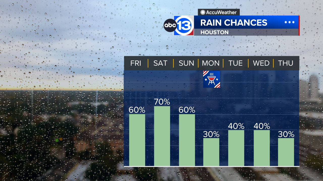
HOUSTON, Texas (KTRK) -- The remnants of Edouard continue to bring storm chances to Southeast Texas, and there's a new area of disturbed tropical weather in the Gulf that will keep the rain chances going for the holiday weekend ahead.
Scattered downpours are popping across the Houston area today. Any storm that pops up could drop a quick inch or two of rain and frequent lightning strikes. Street flooding will be possible in the heavy downpours that erupt near Houston, and flash flooding could occur in any storms that move over the water-logged communities around Lake Livingston. The rain should be mostly gone by the evening, so High School football games should be good to go.
Temperatures will warm to near 90 before the rain-cooled air spreads through Southeast Texas.
What should we expect for Labor Day Weekend?
A fresh surge of tropical moisture arrives Saturday, bringing more widespread showers and thunderstorms. That moisture thins out Sunday and Monday. Expect morning lows in the upper 70s and afternoon highs in the low-to-mid 90s. Many communities on Saturday may not make it out of the 80s due to the more widespread nature of the rain.
What else are you tracking in the tropics?
Aside from Edouard's remnants, we are also tracking 3 hurricanes in the Pacific. For a more in-depth discussion on what's happening in the tropics, visit our Daily Tropical Update page.
13 ALERT RADAR MAPS:
Southeast Texas
Houston
Harris County
Galveston County
Montgomery/Walker/San Jacinto/Polk/Grimes Counties
Fort Bend/Wharton/Colorado Counties
Brazoria/Matagorda Counties
Have weather tips, videos, and photos?
Send it to ABC13 using the form below. If you have a video or photo to send, terms of use apply. If you don't, just hit 'skip upload' and send the details.