Another steamy stretch settles in this week with multiple 100 degree days

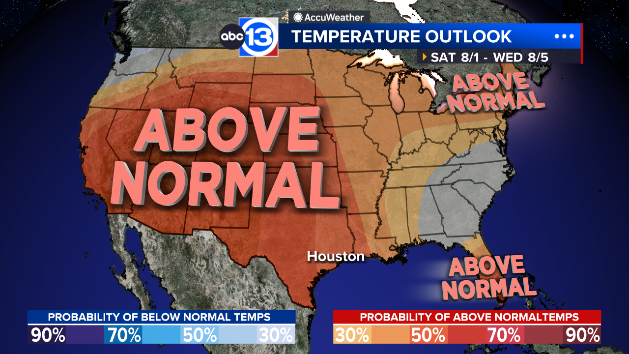
HOUSTON, Texas (KTRK) -- Another summertime heat ridge has arrived and could bring multiple 100 degree days to Houston this week. Factor in the humidity and feels like temperatures will be close to 108 each day where Heat Advisories may be issued as well.
It's a quiet end to the weekend with temperatures falling to the mid-upper 70s overnight. Monday will be another bright and sunny day with a few thin high-level clouds moving in and out at times. The sunshine will help temperatures rise quickly into the mid-upper 90s with an afternoon heat index near 107 expected. There also could be a reduction in air quality for sensitive groups Monday afternoon with this hot and quiet pattern overhead.
How hot will it get this week?
We expect several days when temperatures will be between 100-102 degrees thanks to another summertime heat dome parking itself over the state. Morning lows temperatures will still be in the mid-to-upper 70s, giving us some time to enjoy the day before the true heat sets in during the afternoon. But by the latter portions of next week morning lows will be in the 80s. Steamy starts, scorching afternoons where Heat Advisories may also be needed for the Houston area. The threshold for Southeast Texas to see a Heat Advisory is an afternoon heat index of 08 or more for the majority of the region.
When will the rain chance return?
A summer cool front will get close enough to us next Saturday to warrant at least a 20% chance of rain. Rain chances climb to 30% Sunday through Wednesday of the following week. And while that front may not bring a refreshing cool down, it could help keep a daily rain chance in the forecast next week and help temperatures dip back closer to their seasonal range for the first week of August.
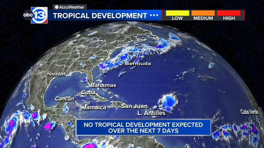
What are you tracking in the tropics?
Saharan dust is blowing through the Atlantic, and there are some systems we are watching in the Pacific. Visit our Tropical Update page for a more in-depth tropical weather discussion and forecast.
13 ALERT RADAR MAPS:
Southeast Texas
Houston
Harris County
Galveston County
Montgomery/Walker/San Jacinto/Polk/Grimes Counties
Fort Bend/Wharton/Colorado Counties
Brazoria/Matagorda Counties
Have weather tips, videos, and photos?
Send it to ABC13 using the form below. If you have a video or photo to send, terms of use apply. If you don't, just hit 'skip upload' and send the details.