Rain chance peaks Thursday, then humidity drops in Houston
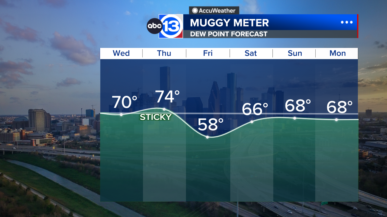

HOUSTON, Texas (KTRK) -- A small rain chance continues Wednesday then spikes on Thursday as another batch of tropical air blows over Houston. Then Friday brings a nice break in the humidity for most of us before tropical air returns this weekend.
We are in for another warm, humid night with lows in the mid-to-upper 70s. Temperatures will quickly warm to the low 90s by noon and peak in the upper 90s for afternoon highs. The record to beat is 98 last observed in 1995, and that is also our forecast high for the day. During the peak heat of the day we've got a 20% chance for a downpour in Houston as the sea breeze pushes in from the coast. These showers will be mostly gone by 7 p.m.
When are the highest chances of rain this week?
Thursday looks to bring the highest rain odds at 40%. That's when the batch of tropical moisture blows in for the day. Then it blows right out by Friday morning, making for a nice humidity drop Friday afternoon.
Are you seeing any signs of a fall front coming this way?
Aside from our humidity break later this week, the best we can probably muster up is a weak front before the end of September. One such front looks to impact us after the weekend with another humidity drop coming in behind it. We will likely have to wait until October to get a true fall front.
What are you tracking in the tropics?
There is one small area we are monitoring for tropical development in the Atlantic while the Pacific continues to crank out storms. For a more in-depth discussion on what's happening in the tropics, visit our Daily Tropical Update page.
13 ALERT RADAR MAPS:
Southeast Texas
Houston
Harris County
Galveston County
Montgomery/Walker/San Jacinto/Polk/Grimes Counties
Fort Bend/Wharton/Colorado Counties
Brazoria/Matagorda Counties
Have weather tips, videos, and photos?
Send it to ABC13 using the form below. If you have a video or photo to send, terms of use apply. If you don't, just hit 'skip upload' and send the details.