Few showers linger Saturday night with hot conditions returning into early next week

HOUSTON, Texas (KTRK) -- A summertime front is moving through Southeast Texas Saturday night but it's not going to drop temperatures.
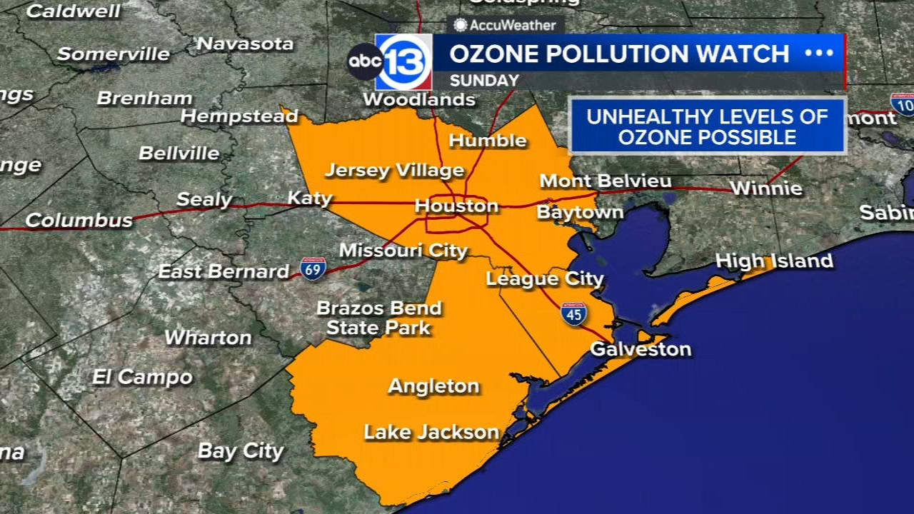
A few showers are possible Saturday evening as the front pushes through Southeast Texas form north to south. By Sunday morning the front should be well offshore, though a couple of showers could linger south of I-10 early Sunday morning. We'll wake up to some cloudiness too with more clearing and sunshine expected for the second half of the day. High temperatures will make it into the upper 90s in the afternoon, and you may notice a drop in humidity levels too Sunday thanks to the cool front. An Ozone Pollution Watch is in effect Sunday for Galveston, Harris and Brazoria counties for Sunday as well.
It's August. How hot are things looking early on this month?
Well, thanks to this summertime cool front from over the weekend there will be a subtle drop in humidity levels for Sunday and Monday. But this will also allow for temperatures to rise a bit more quickly in the afternoon. So with the help of some sunshine too, highs will be in the upper 90s or even triple digits Sunday through Tuesday.
Any more rain in the forecast?
By Wednesday there will be a daily 20% chance for a spot shower or storm to form in the afternoon with the help of the summertime sea breeze. Otherwise, there are currently no other major weather or storm system to track that could bring more widespread rain or severe weather over the next 7-10 days.
What are you tracking in the tropics?
Saharan dust is blowing through the Atlantic with a tropical storm in the Pacific. Visit our Tropical Update page for a more in-depth tropical weather discussion and forecast.
13 ALERT RADAR MAPS:
Southeast Texas
Houston
Harris County
Galveston County
Montgomery/Walker/San Jacinto/Polk/Grimes Counties
Fort Bend/Wharton/Colorado Counties
Brazoria/Matagorda Counties
Have weather tips, videos, and photos?
Send it to ABC13 using the form below. If you have a video or photo to send, terms of use apply. If you don't, just hit 'skip upload' and send the details.