Summer continues to do what summer does, but cooling showers are in the forecast

HOUSTON, Texas (KTRK) -- Our highs will flirt with record territory the rest of this week, but we do have a chance for heat-relieving showers by the weekend. Until then, it's mostly dry with the humidity and heat combo near dangerous levels.
Temperatures Wednesday morning will dip down into the upper 70s, which is near normal for late July. With plenty of sunshine under a partly cloudy sky, temperatures rise quickly into the 90s and peak near 100. Feels like temps will be just shy of meeting the 108-degree threshold for a Heat Advisory.
How hot will it get this week?
We expect a few days this week with triple digit heat thanks to that summertime heat dome. Morning low temperatures will still be in the upper 70s, giving us some time to enjoy the day before the true heat sets in during the afternoon.
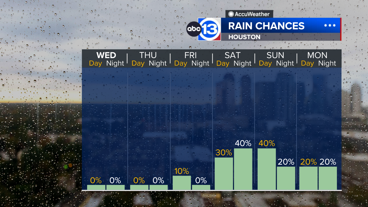
When will the rain chance return?
A summer cool front will get close enough to us by the weekend to warrant at least a 30% chance of rain late Saturday and a 40% chance on Sunday. There's also the chance a few showers and storms could be on the strong side, especially Saturday night.
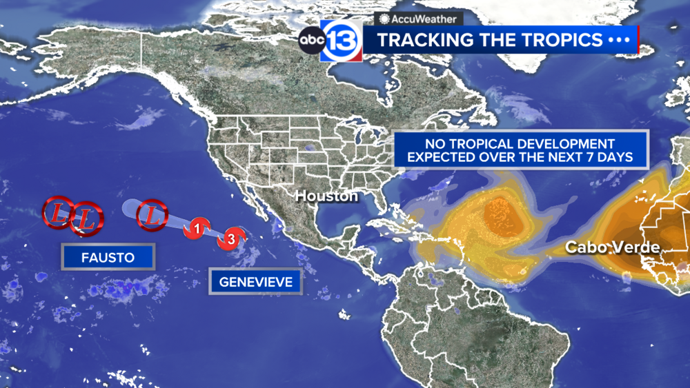
What are you tracking in the tropics?
Saharan dust is blowing through the Atlantic with two named storms in the Pacific. Visit our Tropical Update page for a more in-depth tropical weather discussion and forecast.
13 ALERT RADAR MAPS:
Southeast Texas
Houston
Harris County
Galveston County
Montgomery/Walker/San Jacinto/Polk/Grimes Counties
Fort Bend/Wharton/Colorado Counties
Brazoria/Matagorda Counties
Have weather tips, videos, and photos?
Send it to ABC13 using the form below. If you have a video or photo to send, terms of use apply. If you don't, just hit 'skip upload' and send the details.