ABC13 meteorologist provides perspective for Houston on 2026 hurricane season through analog years


HOUSTON, Texas (KTRK) -- The 2026 Atlantic Hurricane Season Outlook is here, and it hints at a potentially below-average season in terms of activity.
NOAA forecasters are predicting between eight to 14 named storms, three to six hurricanes, and one to three major hurricanes for the 2026 season. Each of these estimates is either at or slightly below the norm for each category.
So where do these numbers come from, and what could it mean for Texans? ABC13 Meteorologist Elyse Smith has more analysis and information on what this could mean for Houston.
The overarching reason for the strong signal pointing to a less active Atlantic hurricane season is the emerging El Niño in the Pacific. At the end of May, water temperatures in the equatorial Pacific Ocean are trending warmer than normal and could continue to warm into the summer months. This would signal that an El Niño has formed, and some long-range computer model guidance suggests this emerging El Niño could strengthen quickly and become a strong El Niño by later this year.
The importance of this phenomenon arriving at this time of year is that it can impact the jet stream over the United States, the Gulf, and the Caribbean. Typically, hurricane seasons with El Niño conditions have favored below-normal activity in the tropics due to wind shear. This is especially true for the Gulf and Caribbean. Wind shear can be a limiting factor in the formation and intensity of tropical storms.
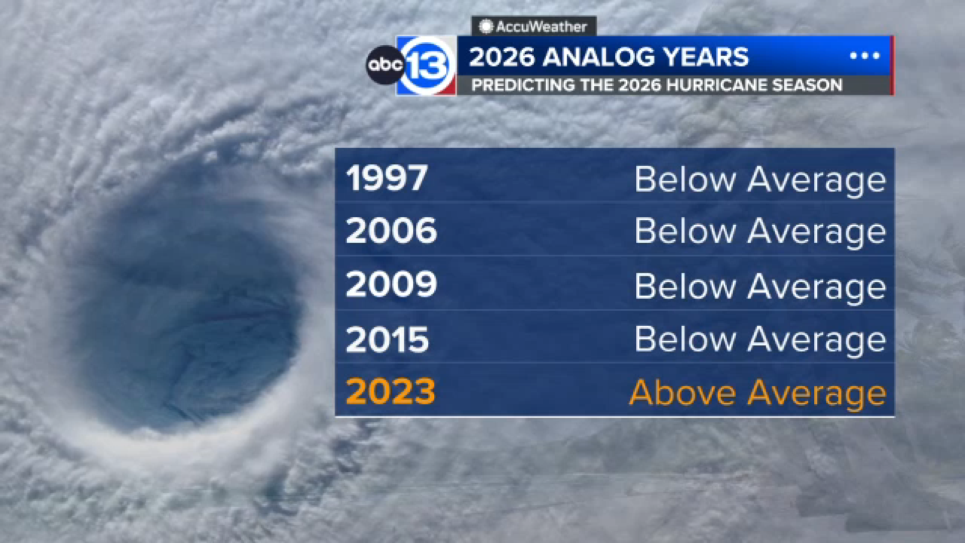
So that's part of the equation. The other is to use historical references and comparisons with previous Atlantic hurricane seasons when similar conditions may have been present. These are called analog years. The analog years used to make the 2026 hurricane season prediction are 1997, 2006, 2009, 2015, and 2023. Each of these years had at least a moderate to strong El Niño during hurricane season, comparable to what could happen this year.
Of the five years, four had below-normal activity in the Atlantic during hurricane season, with some seasons even recording record-low activity. For example, 2006 was previously one of the least active seasons since the 1997 hurricane season. And 2015 was the third of three consecutive years with below-normal activity, too.
But the 2015 season should ring a bell to Houstonians, as that was also the season that brought Tropical Storm Bill to the region. Bill formed from a tropical wave that made it off the west coast of Africa and entered the Gulf. A passing trough then allowed for the system to organize, and in a little over a day, Bill made landfall along Matagorda Island on June 17, 2015, as a tropical storm. Bill brought a 3- to 4-foot storm surge to coastal areas, and its bands of heavy rain led to flash flooding across Southeast Texas. And yes, that was both during an El Niño year and what would end up being a "blow-normal" hurricane season.
The exception is the 2023 season, which is the fourth-most active on record in the Atlantic. The difference here, though, was that the El Niño was paired with record warm water that was already emerging in the deep tropics across the Atlantic. At this time, the waters in the deep tropics aren't warming as quickly as they were in 2023.