May 01, 2026, 9:38 PM GMT
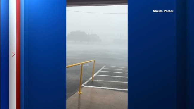
WATCH: Matagorda County viewer shares video showing strong winds

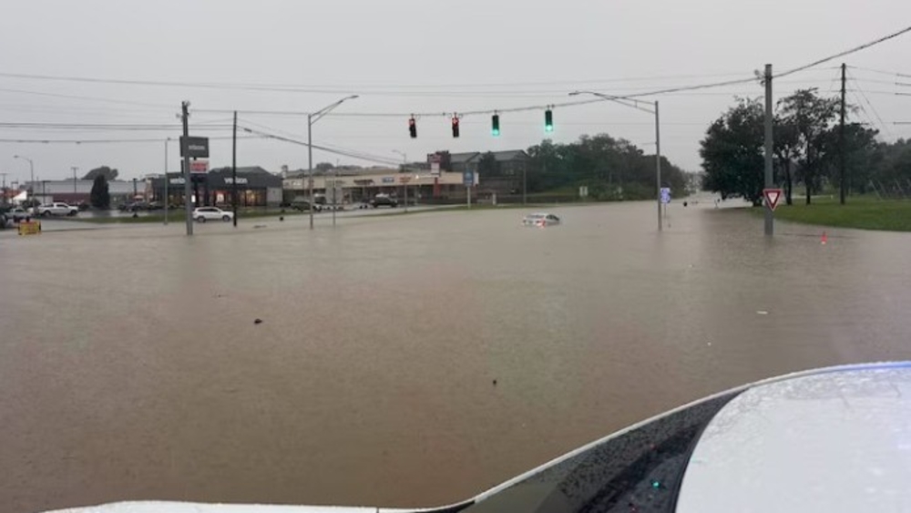
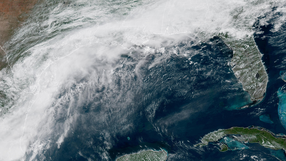
HOUSTON, Texas (KTRK) -- Widespread heavy storms led to street flooding and severe weather on Friday.
A Flood Watch in effect for most of southeast Texas was cut short from expiring at 4 a.m. on Saturday; it is now in effect only until midnight tonight, according to the National Weather Service.
Multiple rounds of rain, including widespread showers during the morning and afternoon commutes, with on-and-off rain continuing through the early evening, were seen.
The last wave of storms was not severe at 7 p.m. and is expected to completely fade after 9 p.m.

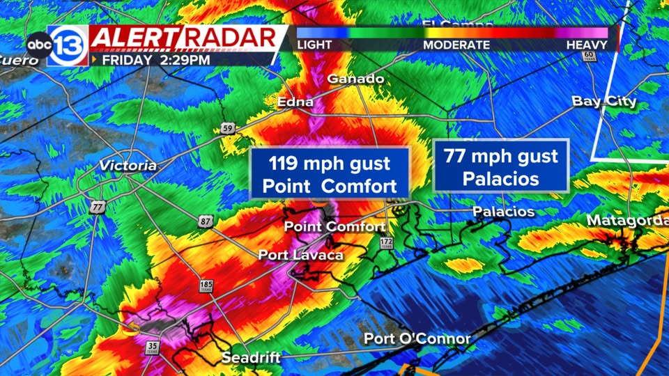
A wicked windstorm tracked through parts of Victoria, Calhoun, and Matagorda counties.
A weather station in Point Comfort recorded a wind gust of 119 mph. All the evidence we have points to straight-line winds rather than a tornado, but with wind gusts like that, it's easy to see why there are reports of things being destroyed and tossed around.
Follow Chief Meteorologist Travis Herzog on Facebook and be sure to send him any photos or videos.
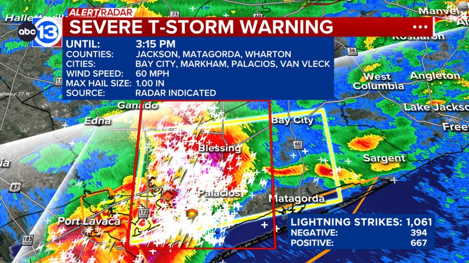
A highly electrified hailstorm is blasting through Matagorda County, moving due east at almost 50 mph.
The severe part of this storm is expected to stay south of Houston and might even miss Galveston Island. It reportedly has produced over 1,000 lightning strikes, meaning 1 or 2 strikes are occurring every second.
In addition to the lightning and torrential rain, quarter-size hail and 60 mph wind gusts are possible.
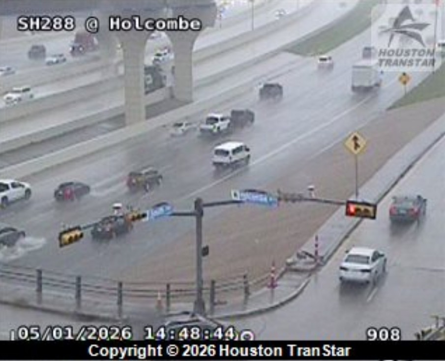
A high-water spot has been located in the Houston area as rain continues to move in through Friday evening.
The spot is localized to Highway 288 northbound near Holcombe Boulevard, Houston TranStar cameras showed.