October is about to begin, what does this mean for the end to hurricane season for southeast Texas?

The tropics remain quite active, with several named systems currently in the Atlantic and another area to monitor in the Caribbean and Gulf of Mexico. This is all occurring as La Niña begins to emerge in the Pacific. So, what does this mean for the rest of the hurricane season?
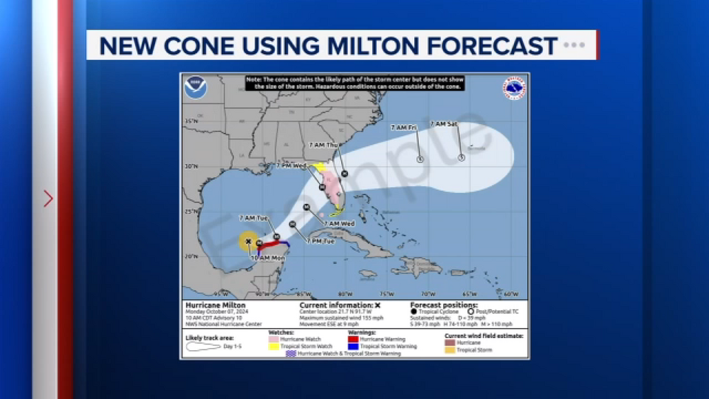
With how active the Atlantic Basin currently is, there are signs that this year's hurricane season could remain active in October and potentially extend into November as well. While this doesn't necessarily correlate to Gulf activity or a Texas landfall, we can't rule out both scenarios. As of Sept. 30, a wave over the western Caribbean has a medium chance of forming over the next seven days. The region where this next system could develop is just where Hurricane Helene formed about a week ago.
While Helene was able to stir up colder water from far below the ocean surface, unfortunately, those waters started to warm again. However, warm water temperatures aren't the only factor influencing whether storms develop and strengthen. Typically, other weather systems will help keep wind shear over the Gulf of Mexico at this time of year, which helps limit tropical activity. ABC13 Meteorologist Elyse Smith spoke to Dr. Phil Klotzbach with Colorado State University. Klotzbach referenced an example from 2020, which involved hurricanes Laura and Marco.
"Marco formed later but actually got into the Gulf earlier. Both traveled over a pretty similar part of the Gulf of Mexico with super hot water. Marco got shredded by sheer and didn't even make it to Louisiana before it died," Klotzbach said.
While there is a window of opportunity in the western Caribbean and the Bay of Campeche for a tropical system to form, wind shear would make it difficult, but not impossible, for a storm to roll into the Gulf. A wide area of shear should move into the Gulf of Mexico over the weekend and early next week, putting a plug on the tropics and keeping a storm away from the Texas coast.
This season has already been active for the Gulf of Mexico. While no two hurricane seasons are exactly alike, many end up having some similarities because of phenomena like El Niño or La Niña.
One of the analog years that forecasters used to predict the 2024 season was 2005, a record year for the total number of storms in the Atlantic and the impacts those storms brought to the U.S. For the Gulf specifically, the 2005 Atlantic hurricane season had 11 storms tracked through the Gulf of Mexico. Eight of those made landfall by the end of August, the last being Hurricane Katrina. Then, there was a lull before another wave of activity brought Rita, Stan, and Wilma to the Gulf from late September through late October.
Now, let's compare that to this year. So far, there have been six named storms in the Gulf. Four happened within the first three months of the season, with hurricanes Francine and Helene in September.
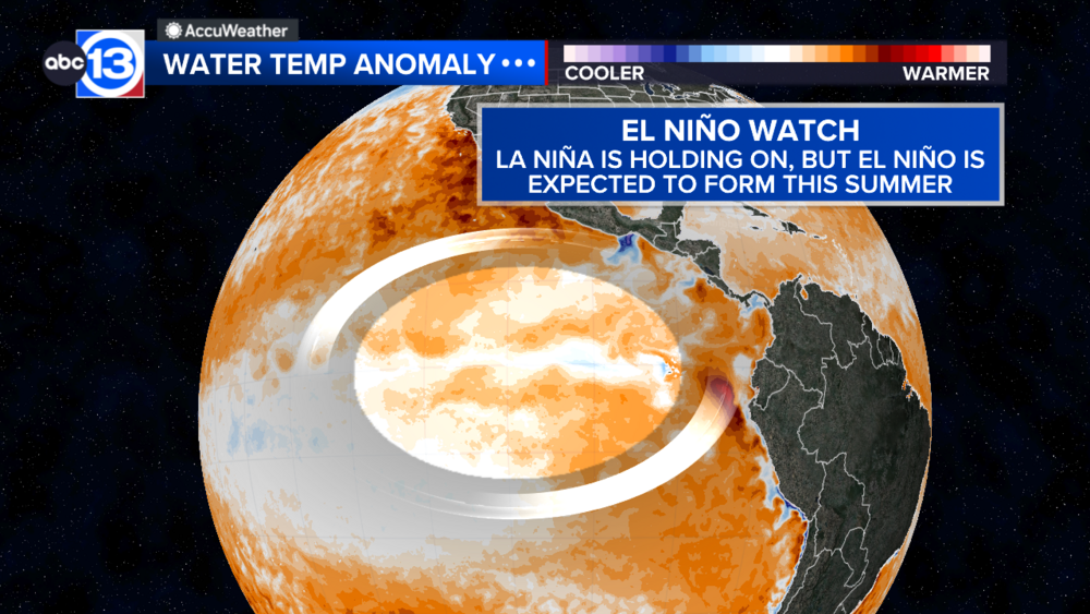
One thing to consider this year is the emerging La Niña. There are already signs of cooler-than-normal temperatures in the Pacific, signaling that a La Niña could take over soon. That's something Klotzbach says to take note of.
"This year, because we likely will have a La Niña and the Atlantic being so hot, this year will probably remain longer, so potentially extending the hurricane season more until late October or early November," Klotzbach said.
For more on this story, follow Elyse Smith on Facebook, X and Instagram.


