Heat and isolated storms this weekend
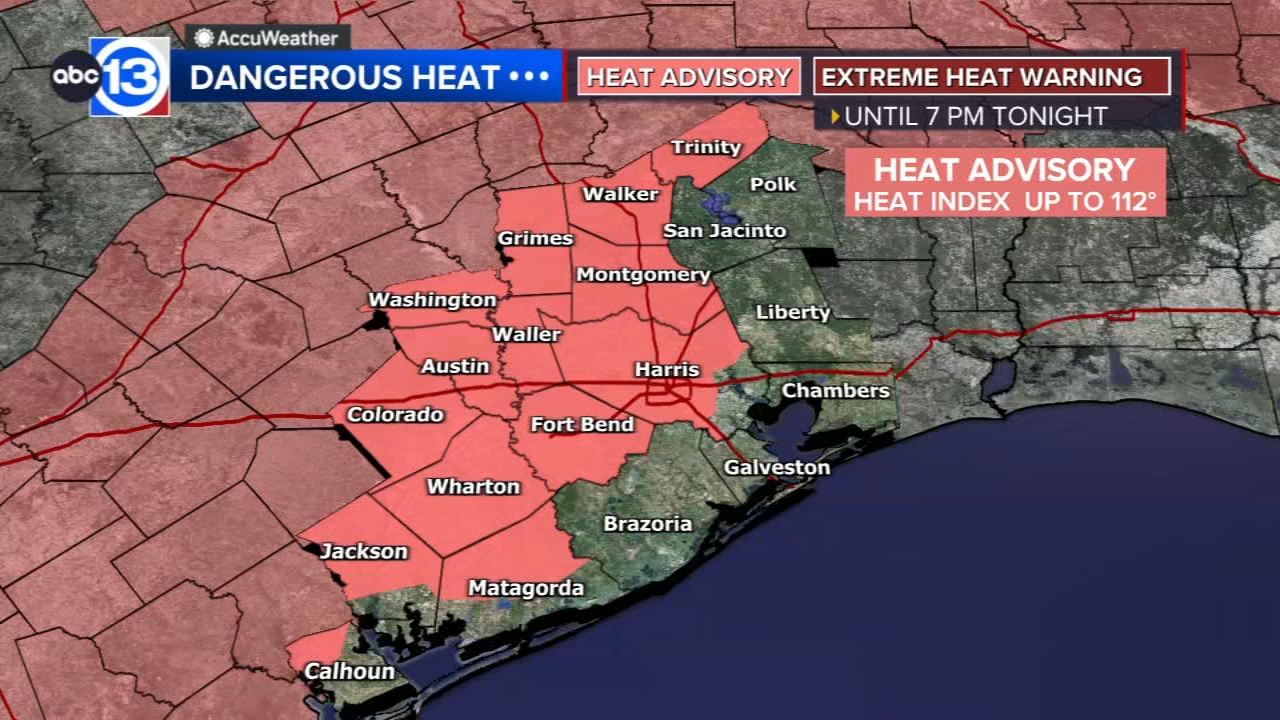

HOUSTON, Texas (KTRK) -- A Heat Advisory has been issued for most of Southeast Texas. All of us will be dealing with the heat, a high of 95 and a feels-like temperatures around 105, and some of us could see an afternoon storm.
What do we expect for our weekend weather?
It will be fairly similar to the last few days. Hot and humid, with scattered storms blossoming around Houston in the early afternoon, capping high temperatures in the low-to-mid 90s. Your chance of rain on Saturday and Sunday is 30%.
Are you seeing any signs of a fall front coming this way?
We do have a weak front reaching Houston about 8 days from now on Sunday, September 20th. It's too soon to know if this front will have enough strength to push all the way through and bring us lower humidity or cooler temps. Regardless, the front should at least bring a chance of rain.
What are you tracking in the tropics?
Norbert has formed in the Pacific, meanwhile the Atlantic remains quiet here at the peak of hurricane season as El Nino remains the strongest on record for this time of year. For a more in-depth discussion on what's happening in the tropics, visit our Daily Tropical Update page.
13 ALERT RADAR MAPS:
Southeast Texas
Houston
Harris County
Galveston County
Montgomery/Walker/San Jacinto/Polk/Grimes Counties
Fort Bend/Wharton/Colorado Counties
Brazoria/Matagorda Counties
Have weather tips, videos, and photos?
Send it to ABC13 using the form below. If you have a video or photo to send, terms of use apply. If you don't, just hit 'skip upload' and send the details.