More scattered downpours coming in the days ahead

HOUSTON, Texas (KTRK) -- If you missed out on Thursdays storms or were hoping for more rain than you got, there are more opportunities for rain in the days ahead.
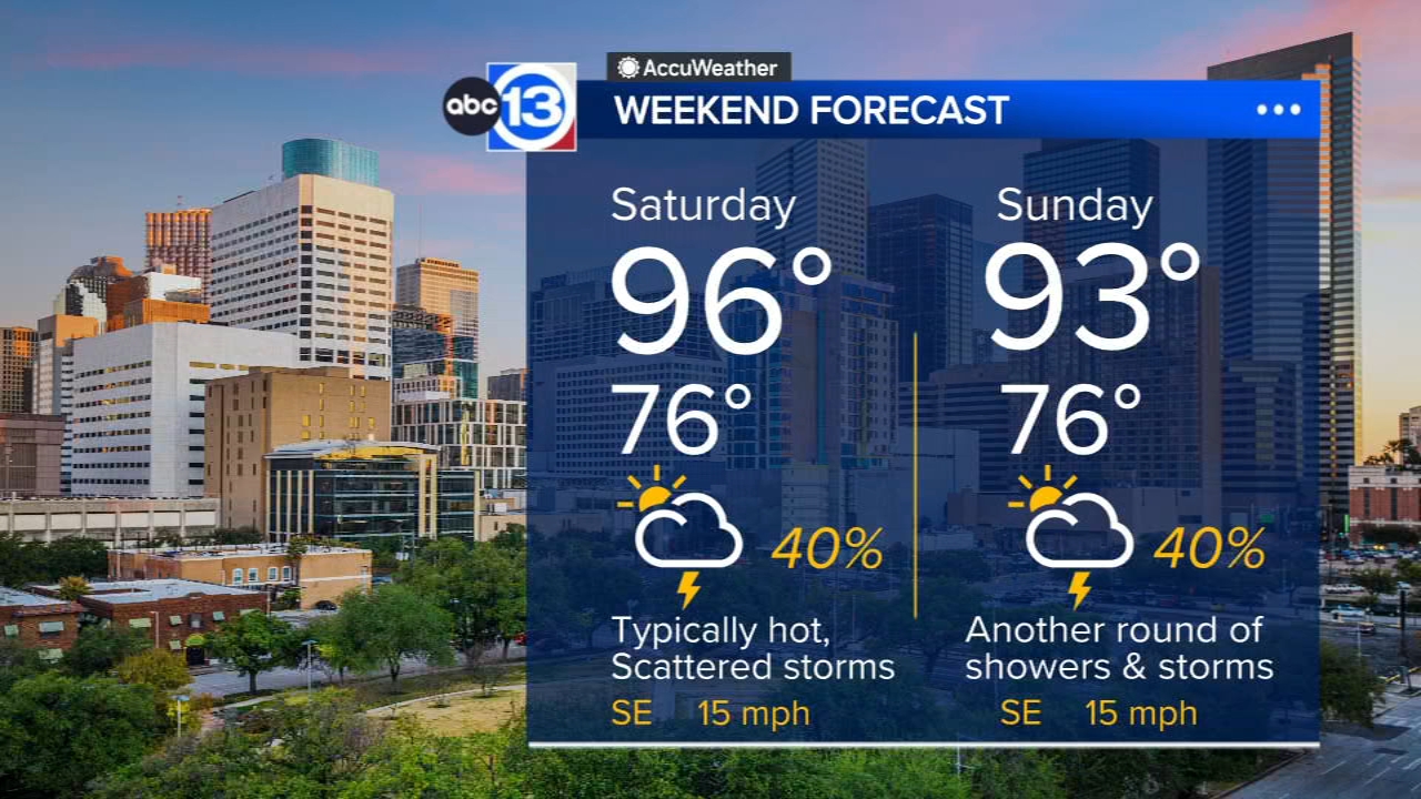
The radar should stay mostly rain-free overnight, but it will be a different story by the afternoon. As temperatures warm from the mid 70s into the mid 90s, thunderstorms will start popping up along the sea breeze front that blows in from the Gulf most afternoons in the summer.
Those showers and storms will march through some Houston-area neighborhoods during the early afternoon. Your chance of rain is 30%. Where it does rain, temperatures will temporarily cool off into the upper 70s and low 80s.
How long will these daily rain chances stick around?
All the way into next week! Afternoon rain chances will range from 30-40% through Sunday, then climb to 60% Monday when a batch of tropical moisture blows overhead. That moisture will depart on Tuesday, and as a heat ridge builds back in, temperatures should start climbing back toward 100 degrees at the end of next week.
What are you tracking in the tropics?
Saharan dust is the primary thing we are tracking in the Atlantic, but there are a couple of disturbances threatening to develop in the Pacific. Visit our Tropical Update page for a more in-depth tropical weather discussion and forecast.
13 ALERT RADAR MAPS:
Southeast Texas
Houston
Harris County
Galveston County
Montgomery/Walker/San Jacinto/Polk/Grimes Counties
Fort Bend/Wharton/Colorado Counties
Brazoria/Matagorda Counties
Have weather tips, videos, and photos?
Send it to ABC13 using the form below. If you have a video or photo to send, terms of use apply. If you don't, just hit 'skip upload' and send the details.