Pop-up showers and storms continue for Labor Day

HOUSTON, Texas (KTRK) -- Pop-up showers and storms continue for Labor Day with the chance for daily downpours all week long.
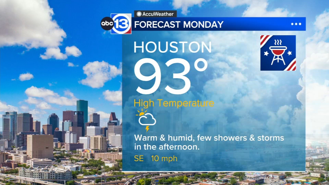
Any showers or storms that developed Sunday afternoon or evening will fizzle out as the sun sets. Temperatures will stay in the upper 80s early on and then fall into the upper 70s by Monday morning. Labor Day is looking to be another warm and humid day with the chance for a few pop-ups in the afternoon and evening with the sea-breeze. The spread of heavy downpours won't be as widespread with not as much tropical moisture overhead for Monday. Temperatures for the day will make it into the low 90s, though communities that pick up some rain with showers and storms will likely hover in the mid-upper 80s throughout the day.
What do rain chances look like this next week?
We keep rain chances around every day, but we'll see the coverage decrease a bit in the coming days. Beyond Monday, the rest of the week will continue bringing scattered afternoon downpours, with coverage varying anywhere from 20-40%. The downpours could be heavy at times too, leading to the possibility for minor street and area flooding that could also allow for Flood Advisories to be issued.
Any more triple digit temperatures in the forecast?
Not as of now, but temperatures will stay above normal into mid-September. That means afternoon high temperatures in the mid to even upper 90s at times over the next 10 days. And when you factor in the humidity, it'll definitely feel like the triple digits with a heat index above 100 in the afternoon.
What else are you tracking in the tropics?
The Atlantic is quiet but we are tracking a tropical storm and a couple of hurricanes in the Pacific. For a more in-depth discussion on what's happening in the tropics, visit our Daily Tropical Update page.
13 ALERT RADAR MAPS:
Southeast Texas
Houston
Harris County
Galveston County
Montgomery/Walker/San Jacinto/Polk/Grimes Counties
Fort Bend/Wharton/Colorado Counties
Brazoria/Matagorda Counties
Have weather tips, videos, and photos?
Send it to ABC13 using the form below. If you have a video or photo to send, terms of use apply. If you don't, just hit 'skip upload' and send the details.