

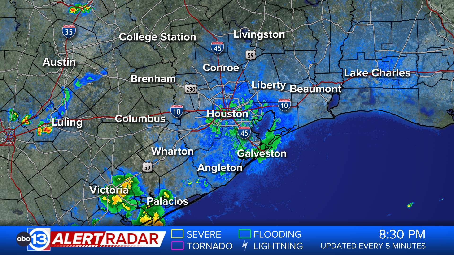
ABC13 Houston Weather Radar for Southeast Texas

- Flood Warning
* WHAT...Flooding caused by excessive rainfall continues. * WHERE...Southwestern Polk County in southeastern Texas... Central San Jacinto County in southeastern Texas... * WHEN...Until 645 AM CDT. * IMPACTS...Flooding of rivers, creeks, streams, and other low-lying and flood-prone locations is imminent or occurring. Low-water crossings are inundated with water and may not be passable especially along FM 3128 northeast of Coldspring and SH 150 west of Shepherd. * ADDITIONAL DETAILS... - At 418 AM CDT, Doppler radar and automated rain gauges indicated heavy rain due to thunderstorms. Flooding is ongoing or expected to begin shortly in the warned area. Between 3 and 6 inches of rain have fallen. - Flooding impacts will continue, and monitoring approaching scattered showers. Flash Flood Guidance is very low in this area due to previous rounds of rainfall, especially near Coldspring. Additional rainfall this morning would likely warrant an upgrade back to a Flash Flood Warning. - Some locations that will experience flooding include... Shepherd, Coldspring and Lake Livingston State Park. - http://www.weather.gov/safety/floodMore
- Flood Warning
* WHAT...Flooding caused by excessive rainfall continues. * WHERE...Northern Liberty County in southeastern Texas... Southeastern Polk County in southeastern Texas... East Central San Jacinto County in southeastern Texas... * WHEN...Until 615 AM CDT. * IMPACTS...Flooding of rivers, creeks, streams, and other low-lying and flood-prone locations is imminent or occurring. Numerous roads remain closed due to flooding. * ADDITIONAL DETAILS... - At 401 AM CDT, Doppler radar indicated heavy rain due to thunderstorms. Flooding is already occurring in the warned area. Between 6 and 16 inches of rain have fallen. - Rainfall is beginning to move back into Polk County. Additional rainfall amounts of 0.5 to 1 inch are possible in the warned area. If rainfall persists for an extended period of time or if rain rates increase, this may need to be upgraded to a Flash Flood Warning again. - Some locations that will experience flooding include... Shepherd, Goodrich, Alabama-Coushatta Reservation and Segno. - http://www.weather.gov/safety/floodMore
- Flood Warning
...The Flood Warning continues for the following rivers in Texas... Menard Creek near Rye affecting Polk, Hardin and Liberty Counties. Long King Creek near Livingston affecting Polk and San Jacinto Counties. For the Menard Creek...including Rye...Moderate flooding is forecast. * WHAT...Moderate flooding is occurring and moderate flooding is forecast. * WHERE...Menard Creek near Rye. * WHEN...Until Saturday morning. * IMPACTS...At 23.0 feet, Moderate lowland flooding begins as low-lying areas along the creek are inundated. * ADDITIONAL DETAILS... - At 2:15 AM CDT Thursday the stage was 24.8 feet. - Bankfull stage is 17.0 feet. - Recent Activity...The maximum river stage in the 24 hours ending at 2:15 AM CDT Thursday was 24.8 feet. - Forecast...The river is expected to rise to a crest of 27.2 feet this evening. It will then fall below flood stage late tomorrow evening. - Flood stage is 20.0 feet. - Flood History...This crest compares to a previous crest of 27.2 feet on 03/30/2018. - http://www.weather.gov/safety/floodMore
- Flood Warning
...The Flood Warning continues for the following rivers in Texas... Menard Creek near Rye affecting Polk, Hardin and Liberty Counties. Long King Creek near Livingston affecting Polk and San Jacinto Counties. For the Menard Creek...including Rye...Moderate flooding is forecast. * WHAT...Minor flooding is occurring and minor flooding is forecast. * WHERE...Long King Creek near Livingston. * WHEN...Until this evening. * IMPACTS...At 19.0 feet, At levels above 19 feet, minor lowland flooding begins as water escapes the main channel of the creek. * ADDITIONAL DETAILS... - At 1:30 AM CDT Thursday the stage was 23.1 feet. - Bankfull stage is 14.0 feet. - Recent Activity...The maximum river stage in the 24 hours ending at 1:30 AM CDT Thursday was 23.7 feet. - Forecast...The river is expected to fall below flood stage late this morning and continue falling to 3.7 feet early Tuesday morning. - Flood stage is 19.0 feet. - Flood History...This crest compares to a previous crest of 23.2 feet on 07/27/2024. - http://www.weather.gov/safety/floodMore
- Flood Warning
* WHAT...Flooding caused by excessive rainfall is ongoing. * WHERE...North Central Liberty County in southeastern Texas... * WHEN...Until 700 AM CDT. * IMPACTS...Flooding of rivers, creeks, streams, and other low-lying and flood-prone locations is imminent or occurring. Low-water crossings are inundated with water and may not be passable. * ADDITIONAL DETAILS... - At 1258 AM CDT, Doppler radar indicated heavy rain due to thunderstorms. Flooding is already occurring in the warned area. Between 6 and 10 inches of rain have fallen. - Flooding impacts will continue, but no additional rainfall is expected. - Some locations that will experience flooding include... Moss Hill. - http://www.weather.gov/safety/floodMore


