It's going to be a wet start to the new school year with scattered storms Monday

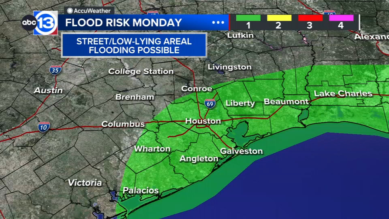
HOUSTON, Texas (KTRK) -- It's going to be a wet start to the new school year with scattered storms expected once again on Monday. But this time, heavy downpours could lead to pockets of street flooding.
Any showers or storms that developed with the help of the seabreeze will fizzle out tonight as the sun goes down. It stays dry through the overnight hours with temperatures falling from the upper 80s to upper 70s overnight. Monday could be the rainiest of this work and school week as the seabreeze brings another round of showers and storms. Pockets of moderate to heavy downpours, thunder and lightning are all possibilities with Monday's storms. Otherwise this rain will help temperatures form climbing too high on Monday with most areas staying in the upper 80s or low 90s. Communities that dont pick up any rain could see highs in the mid 90s.
How will Monday's storms impact all those going back to school?
With tropical air blowing in Monday, rain chances will climb to 60%. In this type of pattern, we usually have scattered activity near the coast around sunrise, with widely scattered downpours developing around Houston from the late morning to the early afternoon. Then things calm down for the evening. Based off that timeline, getting to school should be fine for most, but recess, outdoor after-school activities, and pick up at the end of school could all be impacted by a heavy downpour. Rain rates could exceed 2" per hour in the heavier storms, leading to brief street flooding.
How about the rest of the week?
After Monday, rain chances begin tapering off. A few showers and storms are possible once again Tuesday afternoon and evening. Then your chance of seeing any rain from Wednesday on is at 20% or less each day, with more sunshine and hotter temperatures.
What's happening in the tropics?
The tropical wave train off the west coast of Africa is beginning to take shape. There are two regions to watch for potential tropical development over the next 7 days with one wave currently in the mid-Atlantic and another just entering it. The wave farther to the west has a low chance of developing into a tropical system before reaching the Caribbean. Then the wave farther east in the Atlantic could form into the next tropical system of the 2026 Atlantic season later this week.
13 ALERT RADAR MAPS:
Southeast Texas
Houston
Harris County
Galveston County
Montgomery/Walker/San Jacinto/Polk/Grimes Counties
Fort Bend/Wharton/Colorado Counties
Brazoria/Matagorda Counties
Have weather tips, videos, and photos?
Send it to ABC13 using the form below. If you have a video or photo to send, terms of use apply. If you don't, just hit 'skip upload' and send the details.