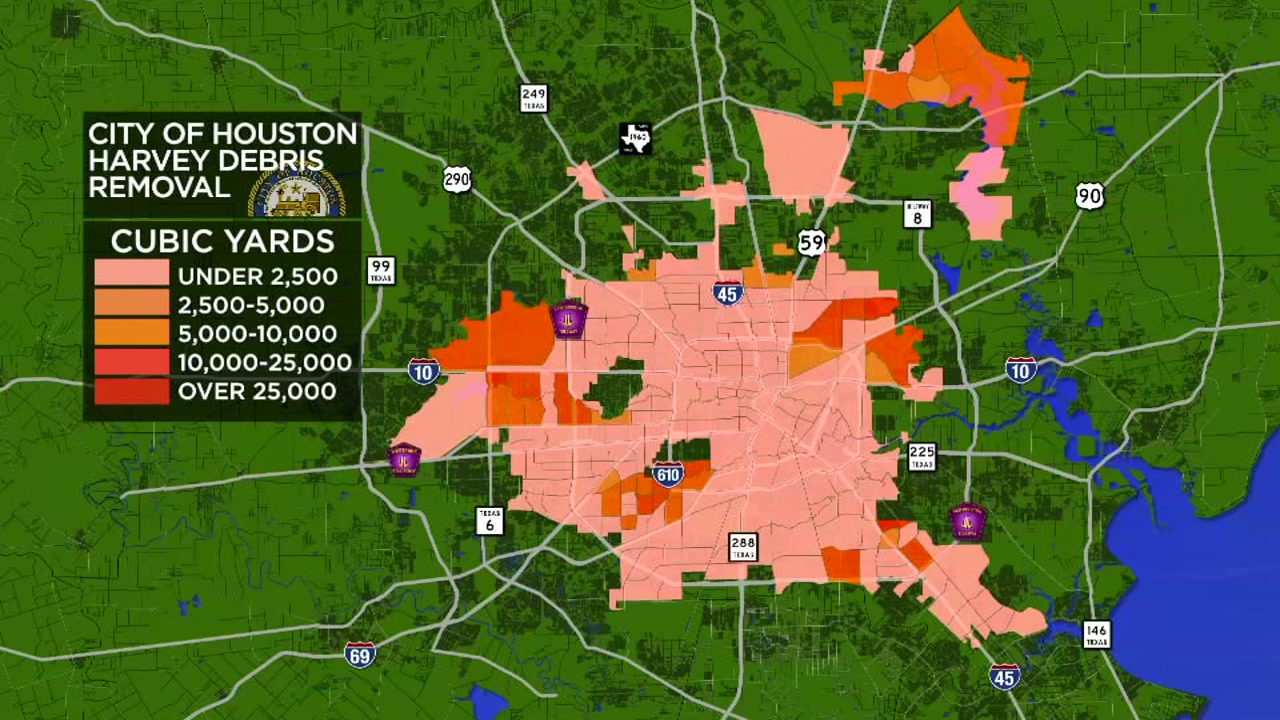
First look at maps of the debris removal progress in Houston


HOUSTON (KTRK) -- In Bruce Anderson's Linkwood neighborhood, progress is measured by how many debris trucks are passing through each day. A month after Harvey, Anderson's front yard is mostly clear.
"I wasn't in a position to carry it away myself, we couldn't eat it, and from what I can tell there are a lot of people buried in their work right now," said Anderson, who emphasized he is grateful for the crews working long hours to remove debris.
Still, for Houstonians still waiting, many simply want to know how many trucks to expect in their subdivision and what time, on any given day.
The reality is, even their City Council members likely do not know.
"Myself and my colleagues would really appreciate it if we had more information," said Council Member Robert Gallegos.
Every morning, Gallegos, his staff, and his colleagues get three maps. One map shows how much debris was collected in each area of the city the day before, another shows how much debris has been collected in totality, and one more showing how many debris trucks are in a council district on any given day.
That may sound like a lot of information, but the lack of specific details can be frustration. The maps, produced in PDF form, are also not very user friendly.
We asked Gallegos if he found the maps useful. "In my personal opinion, no," he said.
Other council members have printed their own maps and use pushpins to keep track of debris removal. Several tell us they find driving around their district and getting calls from constituents to be more effective in gaining information on truck locations.
Eyewitness News took the latest debris removal map and attempted to make it more user friendly. We took the latest information and developed a map where the darker the shade of red indicates the more debris collected.
Meanwhile, Eyewitness News has requested interviews with the City's Solid Waste Director, Harry Hayes, to better explain the information that is available. So far, our requests have not been granted. However, the City of Houston is working to make the maps sent to council members available to the public. A web link could be available as early as Friday
Gallegos admits, it's challenging to provide all the information everyone would like to see.
"Solid Waste, City of Houston, we are doing the best we can," he says. Like many officials we have spoken to, Gallegos is praising the crews who are working long hours, while holding out hope that there would be more data available to all.
Eyewitness News has obtained these maps by the City of Houston, as of Thursday: