NASA images with thick plumes of smoke illustrate spread of wildfire

Tuesday, August 18, 2015
This image captured by NASA's Aqua satellite shows wildfires over the Pacific Northwest on August 16. For reference, the Canyon Creek complex is in central northeast Oregon.
This image shows the same area on August 13. The red lines indicate areas of extreme heat, generally associated with fires.
This image captured by NASA's Aqua satellite shows wildfires near the California-Oregon state line on August 5.
NASA shared these satellite images on August 17.
This false color image shows the impact of the Rocky fire, now 100 percent contained, which was northeast of San Francisco. The red is charred vegetation.
A firefighting helicopter flies near a smoke plume on July 31.
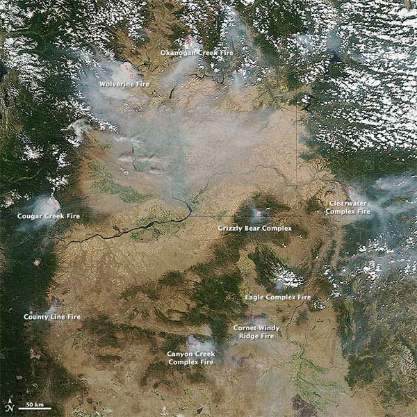
NASA images with thick plumes of smoke illustrate spread of wildfireThis image captured by NASA's Aqua satellite shows wildfires over the Pacific Northwest on August 16. For reference, the Canyon Creek complex is in central northeast Oregon.
NASA/LANCE/EOSDIS Rapid Response